
Devil's rise
| Devil's rise | |
|---|---|
| Data | |
| length | 26 km |
| location | Lower Saxony , Saxony-Anhalt |
| Markers | Stylized devil in white on a green background |
| Starting point |
Bad Harzburg 51 ° 52 ′ 15.6 ″ N , 10 ° 33 ′ 39.3 ″ E |
| Target point |
Misery 51 ° 44 '40.2 " N , 10 ° 41' 4.4" E |
| Type | Distance hiking trail |
| Height difference | 849 m |
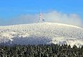
| The highest point | Brocken (1141.2 m) |
| Lowest point | Burgberg cable car valley station (292 m) |
| Level of difficulty | medium |
| season | Spring to autumn |
| Viewpoints | Brocken, Scharfenstein , Snore Cliffs |
The Teufelsstieg is a 26 kilometer long hiking trail in the north of Central Harz in Lower Saxony and Saxony-Anhalt. It connects Bad Harzburg in the north with Elend in the south and leads over the Brocken , the highest elevation in the low mountain range.
history
In 2005 the 13 kilometer long Teufelsstieg between Bad Harzburg and the Brocken summit was officially opened. Nine years later, a second stage was signposted. Since 2014 it has been leading from the Brocken down south to Elend. This section is also about 13 kilometers long.
Stages
The following stages are suggested on the official website of the tourist office of the town of Oberharz am Brocken :
- Stage 1: Bad Harzburg (valley station Burgbergseilbahn) - Ettersklippe - Molkenhaus - Braunschweiger Weg - Eckertal with Eckertalsperre - Scharfenstein - Kleiner Brocken - Brocken (13 km, 1015 meters in altitude )
- Stage 2: Brocken - Brockengarten - Eckerloch - Black Schluftwasser - Schluftwiesen - Schierke - Mauseklippe - Schnarcherklippen - Elendstal - misery (13 km, 809 meters altitude)
Integration into the local network of hiking trails
On the Brocken summit, the Teufelsstieg crosses the Harzer Hexenstieg and the Harzer Grenzweg . In misery it is connected to the southern Brocken bypass of the Harzer Hexenstieg. At the Molkenhaus and in Bad Harzburg, the Teufelsstieg meets the Kaiserweg .
The Molkenhaus (no.169), the Eckertalsperre (no.1), the Scharfenstein ranger station (no.2), the Brockenhaus ( no.9 ), the Eckerloch (no.11) and the Schnorerklippen (no.14) are in the system of the Harz hiking pin included.
photos

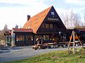
Valley station and parking lot Burgbergseilbahn
Whey house

Eckertalsperre

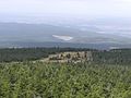
Scharfenstein ranger station
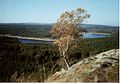
View from the Scharfenstein
Small chunk with Hirtenstieg
Chunks

Second hand

Eckerlochstieg

Mouse cliff

Southwest snorer cliff

Look at misery


Web links
- Devil's rise. Spa, tourism and business operations of the city of Bad Harzburg GmbH, accessed on January 21, 2017 .
- Harzer Teufelsstieg: Bad Harzburg - Brocken - misery. Harz-Wanderkarten.de, accessed on January 22, 2017 .
Individual evidence
- ↑ a b Der Teufelsstieg - In the footsteps of Goethe. Tourist office of the city of Oberharz am Brocken, accessed on January 21, 2017 .
- ↑ a b Paths to the Brocken - Teufelsstieg. Outdooractive, accessed January 21, 2017 .
