
Eckertalsperre
| Eckertalsperre | |||||
|---|---|---|---|---|---|
 |
|||||
|
|||||
|
|||||
| Coordinates | 51 ° 50 '8 " N , 10 ° 35' 15" E | ||||
| Data on the structure | |||||
| Construction time: | 1939-1943 | ||||
| Height above valley floor: | 57.0 m | ||||
| Height above foundation level : | 65.0 m | ||||
| Height of the structure crown: | 599 m above sea level NN | ||||
| Building volume: | 168,000 m³ | ||||
| Crown length: | 235.0 m | ||||
| Crown width: | 2.2 m | ||||
| Slope slope on the air side : | 1: 0.68 m | ||||
| Slope slope on the water side : | 1: 0.02 m | ||||
| Power plant output: | 2 × 300 kW | ||||
| Operator: | Harz waterworks | ||||
| Data on the reservoir | |||||
| Altitude (at congestion destination ) | 557.95 m above sea level NN | ||||
| Water surface | 68 ha (0.68 km²) | ||||
| Storage space | 13.27 million m³ | ||||
| Catchment area | 17.0 km² | ||||


The Eckertalsperre (rarely also called Eckerstausee) is a dam near Bad Harzburg in the Harz Mountains , which was put into operation in 1943 and dams the Ecker and its tributaries. The system operated by the Harz waterworks provides drinking water , flood protection , low water elevation and energy generation .
technology
The dam has a gravity dam as a barrier structure . For the first time in Germany, coarse vibrated concrete with aggregate up to a grain size of 300 millimeters was used. The wall weighs 420,000 tons .
The storage space uses a section of the valley that was carved out like a basin by an ice age glacier below a clear valley step. The Eckertalsperre has an average annual discharge of 16 million cubic meters.
History and border situation
After the Sösetal and Odertalsperre dams, the Eckerstaumauer was the third modern dam structure in the Harz. In the upper catchment area of the plug on chunks are field long-term average rainfall of 1372 mm registered per year and reached speeds of 1700 mm. The reservoir thus receives the highest amounts of precipitation of all Harz reservoirs.
The dam hardly increases the low water level , as its catchment area comprises only half of the tributaries in the Harz.
The reservoir was also planned for the increasing demand for drinking water in the region. This increased in the 1930s due to the planned construction of the Volkswagen factory together with the "City of the KdF-Wagons near Fallersleben " (since 1945: Wolfsburg ) and the growing population of Braunschweig . The dam was built in the middle of World War II. Several hundred foreign workers and prisoners of war were also used for the work .
At the time of the division of Germany , the inner-German border ran right through the storage space and dam ; only about two thirds of this was open to the public on the west side. The eastern part of the top of the wall was separated from the border troops of the GDR with a brick wall and barbed wire . Access rights to the dam were only regulated in bilateral agreements between the Federal Republic of Germany and the German Democratic Republic at the end of the 1970s . The old GDR border column on the barrier structure has been preserved.
Drinking water supply
The reservoir serves to supply the cities of Braunschweig , Wolfenbüttel and Wolfsburg with drinking water . The water is directed to the Lewerberg elevated reservoir near Liebenburg , where the drinking water from the Granetalsperre also arrives. From there, a line leads to Thieder Lindenberg and on to the major cities of Braunschweig and Wolfsburg.
The water in the Ecker is relatively acidic due to the humic acid-containing peat streams with a pH of 4.6. In addition, it is low in nutrients and therefore well suited for drinking water treatment. The dam is not used for the fishing industry, as most fish cannot tolerate the low pH value. The water below the dam is almost neutral.
Hydropower
The output of the hydropower plant below the dam is 2 x 300 kilowatts; the electrical work gained annually in this way reaches up to 1.4 million kWh. In addition, water power is used at the Lewerberg and an annual electrical work of up to 500,000 kWh is generated.
hike
The Eckertalsperre is not accessible by car for private individuals. The 10.1 km long Eckerstausee circular route leads around the reservoir . The dam wall is included as No. 1 (Eckertalsperre dam) in the system of stamping points of the Harz hiking pin.
gallery

Dam wall
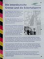
Information board on the former inner-German border

Former GDR border column on the dam wall


literature
- Martin Schmidt : Dams in the Harz. East and West Harz. 9th edition, updated by Rainer Tonn. Papierflieger Verlag GmbH, Clausthal-Zellerfeld 2012, ISBN 978-3-86948-251-4
- Peter Franke, Wolfgang Frey: Dams in the Federal Republic of Germany . Systemdruck, Berlin 1987, ISBN 3-926520-00-0 .
See also
Web links
- The Eckertalsperre , on harzwasserwerke.de
- The Eckertalsperre , on harzlife.de
- GDR border on the dam in the Harz Mountains in 1978 (photo), on flickr.com
- Eckertalsperre water profile , entry from 2013, accessed November 11, 2014, at anglermap.de
Individual evidence
- ↑ a b c d e f g h i j k l m n The Eckertalsperre (Flyer), on harzwasserwerke.de
- ↑ The Eckertalsperre (main page), on harzwasserwerke.de
- ↑ a b c NLWKN : Water quality report Oker 2002 , Braunschweig 2002, Internet presence of the State of Lower Saxony as of June 2013
- ↑ Friedhart Knolle : On the use of foreign workers and prisoners of war in the construction of the Eckertalsperre in: Unser Harz, No. 3/2013, Verlag Fischer & Thielbar, Clausthal-Zellerfeld, 2013
- ↑ Eckertalsperre water profile , entry from 2013, accessed November 11, 2014, at anglermap.de
- ↑ Eckerstausee circular route , on outdooractive.com
- ↑ Harzer hiking pin: stamp point 1 / Eckertalsperre (dam) (Eckertalsperre dam) , on harzer-wandernadel.de