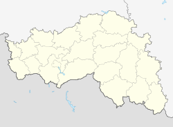
Tomarowka
| Urban-type settlement
Tomarovka
Томаровка
|
||||||||||||||||||||||||||||
|
||||||||||||||||||||||||||||
|
||||||||||||||||||||||||||||
Tomarowka ( Russian Томаровка ) is an urban-type settlement in Belgorod Oblast ( Russia ) with 8094 inhabitants (as of October 14, 2010).
geography
The settlement is located about 30 kilometers as the crow flies northwest of the Belgorod Oblast Administrative Center , on the upper reaches of the Dnepr tributary Worskla .
Tomarowka belongs to the Jakowlewo Rajons and is about 20 kilometers to the southwest from its administrative center Stroitel .
history
The place was founded in 1658. By the middle of the 19th century it had developed into an important local handicraft and trade center: five annual fairs were held; the population exceeded today's.
During the Second World War , the place was initially occupied by the German Wehrmacht from October 25, 1941 to February 20, 1943 . In a counter-attack, the Wehrmacht was able to take Tomarowka again on March 20, until it was finally recaptured by the Red Army on August 5, 1943, during the battle in the Kursk Arc , on the southern flank of which it was advancing over Belgorod. During these months the place was in the immediate vicinity of the front and was badly destroyed.
In 1968 Tomarowka received urban-type settlement status.
Population development
| year | Residents |
|---|---|
| 1877 | 10,037 |
| 1897 | 8,716 |
| 1939 | 6,198 |
| 1959 | 4,974 |
| 1970 | 6,388 |
| 1979 | 6,798 |
| 1989 | 7.165 |
| 2002 | 7,816 |
| 2010 | 8.094 |
Note : from 1897 census data
Economy and Infrastructure
In Tomarowka there are factories in the food and construction industries and a factory for agricultural equipment.
The railway line from Belgorod to Sumy in the Ukraine runs through Tomarowka . To the southeast, the location is bypassed by the regional road R 186 , which leads from Belgorod to the Ukrainian border in the direction of Ochtyrka . In Tomarowka the road branches off from this to the district administrative centers of Rakitnoye and Krasnaya Yaruga in the west of the oblast. In a northeasterly direction there is a connection to the district center Stroitel on the federal trunk road M2 , which connects Moscow via Belgorod with the Ukrainian border in the direction of Kharkiv .
Individual evidence
- ↑ a b Itogi Vserossijskoj perepisi naselenija 2010 goda. Tom 1. Čislennostʹ i razmeščenie naselenija (Results of the All-Russian Census 2010. Volume 1. Number and distribution of the population). Tables 5 , pp. 12-209; 11 , pp. 312–979 (download from the website of the Federal Service for State Statistics of the Russian Federation)
Web links
- Yakovlevo Raion Administration website , with information on Tomarowka (Russian)

