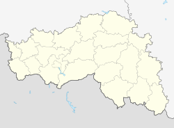
Waluiki
| city
Waluiki
Valuki
|
||||||||||||||||||||||||||||||||||||||
|
||||||||||||||||||||||||||||||||||||||
|
||||||||||||||||||||||||||||||||||||||
| List of cities in Russia | ||||||||||||||||||||||||||||||||||||||
Waluiki ( Russian Валуйки ) is a city in Belgorod Oblast ( Russia ) with 35,322 inhabitants (as of October 14, 2010).
geography
The city is located about 150 km southeast of the Oblast capital Belgorod a few kilometers east (left) of the Oskol , a left tributary of the Seversky Donets flowing into the Don .
Waluiki is administratively directly subordinate to the Oblast and at the same time the administrative center of the Rajon of the same name .
history
The place was founded in 1593 as a fortress on what was then the southern border of the Russian Empire and named after the nearby Walui river that flows into the Oskol.
In 1797 city charter was granted.
During the Second World War , Waluiki was occupied by the German Wehrmacht on July 6, 1942 and recaptured on January 19, 1943 by troops of the Voronezh Front of the Red Army as part of Operation Ostrogoschsk-Rossosh .
Population development
| year | Residents |
|---|---|
| 1897 | 6,698 |
| 1926 | 10,243 |
| 1939 | 18,747 |
| 1959 | 18,068 |
| 1970 | 29.093 |
| 1979 | 32,109 |
| 1989 | 34,863 |
| 2002 | 35,790 |
| 2010 | 35,322 |
Note: census data
Culture and sights
A number of buildings from the 19th and early 20th centuries have been preserved in Waluiki, such as the grammar school , the elementary school , the Volkshaus and a hotel.
Nearby, on the banks of the Oskol, the remains of the Assumption and Nikolai Monastery ( Успенский Никольский монастырь / Uspenski Nikolski monastyr), founded in the early 17th century, and a cave monastery in the local chalk cliffs have been preserved.
The city has a local museum and a history and art museum .
economy
In Waluiki, companies in the food industry predominate, in addition there are companies for metal processing and the building materials industry.
The city is an important railway junction that emerged towards the end of the 19th century. This is where the Kharkiv - Balashov - Penza and Moscow - Jelez - Donets Basin routes intersect (km 750).
Waluiki is located on the R187 Novy Oskol - Rowenki regional road .
sons and daughters of the town
- Alexander Kokorin (* 1991), football player
- Alexander Moskaljow (1904–1982), aircraft designer
See also
Individual evidence
- ↑ a b Itogi Vserossijskoj perepisi naselenija 2010 goda. Tom 1. Čislennostʹ i razmeščenie naselenija (Results of the All-Russian Census 2010. Volume 1. Number and distribution of the population). Tables 5 , pp. 12-209; 11 , pp. 312–979 (download from the website of the Federal Service for State Statistics of the Russian Federation)
Web links
- Waluiki on mojgorod.ru (Russian)


