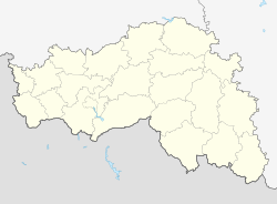
Korocha
| city
Korocha
Короча
|
||||||||||||||||||||||||||||||||||||||
|
||||||||||||||||||||||||||||||||||||||
|
||||||||||||||||||||||||||||||||||||||
| List of cities in Russia | ||||||||||||||||||||||||||||||||||||||
Korotscha ( Russian Короча ) is a small town in the Belgorod Oblast ( Russia ) with 5877 inhabitants (as of October 14, 2010).
geography
The city is located about 60 km northeast of the Oblast capital Belgorod on the Korotscha river of the same name , a tributary of the Neschegol in the river system of the Don .
Korotscha is the administrative center of the Rajon of the same name .
history
A small Russian fortress already existed on the Korotscha in the first quarter of the 17th century . Settlement in the area of today's city has been secured since the expansion of the Belgorod - Tambow - Simbirsk defensive line along the then southern border of the Russian Empire to ward off the Crimean Tatar attacks from 1638.
Initially called Krasny gorod na Korotsche ( Beautiful City on the Korotscha ), the short form Korotscha soon became naturalized after the river, under which the city charter was granted in 1708 . The name indicates the “brevity” of the river (derived from Russian korotki for short ).
Up until the early 20th century one of the larger district towns in the region, Korotscha lost its importance afterwards.
During the Second World War , Korotscha was occupied by the German Wehrmacht on July 1, 1942 and recaptured on February 7, 1943 by troops of the Voronezh Front of the Red Army as part of the Battle of Kharkov .
Population development
| year | Residents |
|---|---|
| 1897 | 10,235 |
| 1926 | 14,100 |
| 1939 | 5,413 |
| 1959 | 3,927 |
| 1970 | 5,402 |
| 1979 | 5,640 |
| 1989 | 5,755 |
| 2002 | 6,046 |
| 2010 | 5,877 |
Note : census data (1926 rounded)
Economy and Infrastructure
In Korotscha, companies in the food industry dominate.
The city is located on the regional road R185 Belgorod - Nowy Oskol - Alexejewka - Rossosh , from which the R189 branches off to Stary Oskol .
sons and daughters of the town
- Ivan Dwigubski (1771–1840), naturalist and rector of Moscow University
- Alexei Pogorelow (1919–2002), Soviet mathematician
See also
Individual evidence
- ↑ a b Itogi Vserossijskoj perepisi naselenija 2010 goda. Tom 1. Čislennostʹ i razmeščenie naselenija (Results of the All-Russian Census 2010. Volume 1. Number and distribution of the population). Tables 5 , pp. 12-209; 11 , pp. 312–979 (download from the website of the Federal Service for State Statistics of the Russian Federation)
Web links
- Korotscha on mojgorod.ru (Russian)


