Treidelheim (Rennertshofen)
|
Treidelheim
Rennertshofen market
Coordinates: 48 ° 45 ′ 38 " N , 11 ° 3 ′ 42" E
|
|
|---|---|
| Height : | 395 m |
| Residents : | 156 (Jul 31, 2020) |
| Postal code : | 86643 |
| Area code : | 08434 |
|
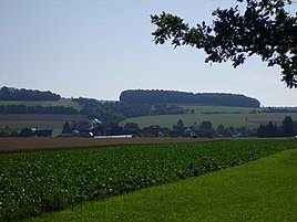
Treidelheim, seen from the west
|
|
Treidelheim is a church village and part of the Rennertshofen market in the district of Neuburg-Schrobenhausen in the administrative district of Upper Bavaria . Together with Gut Siglohe, it belongs to the district of walls .
location
Treidelheim is located in the southern Franconian Jura north-northeast of the main town Rennertshofen at the transition from the Danube plain to the Wellheim dry valley . The village can be reached via the state road St 2047 , which leads from the Rennertshofener district of Hatzenhofen over walls to Dollnstein . The Sprösselbach flows through the village.
history
The place is first mentioned in 1291 as "Trudelnheim". It belonged to the Counts of Lechsgemünd-Graisbach , from the 16th century to the Count Palatinate of Neuburg , and later to the Churpfalzbaierischen Duchy of Neuburg until the beginning of the 19th century. The Meierhof owned the Niederschönenfeld Monastery , transferred in 1358 by Friderich, Duke of Teck (Teckg) .
In the Kingdom of Bavaria Treidelheim belonged to the Rennertshofen tax district in the Graisbach- Monheim district court and rent office . With the community edict of 1818, the village, at that time home to 32 families, became part of the community walls in the district court of Neuburg an der Donau .
In 1867, 117 people lived in the village with its 47 buildings. In 1879/80 the municipality of Mauern, to which Treidelheim and Siglohe belonged, came to the district office and district court of Neuburg an der Donau, which later became the Swabian district of Neuburg. In this district, Mauern and its districts remained an independent municipality until 1978. The census of June 6, 1961 showed that Treidelheim had 182 residents and 35 residential buildings. The district of Neuburg came to Upper Bavaria as part of the regional reform in Bavaria in 1972 and on May 1, 1973 was named the district of Neuburg-Schrobenhausen . On May 1, 1978 the incorporation of walls with Treidelheim and Siglohe into the Rennertshofen market took place; Since then, Treidelheim has been one of 28 officially named districts of Rennertshofen.
Catholic branch church St. Vitus
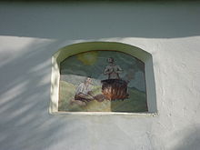
The branch church of St. Vitus, which belongs to the Catholic parish of Mauern, is located on the eastern edge of the village. Along with Pfalz-Neuburg, Treidelheim was also temporarily Protestant; the late Romanesque church was converted into a residential building during this period. In 1632 the sacred building was destroyed by the Swedes in the Thirty Years War and restored in 1640 using the remains of the wall from the previous church. In the middle of the 18th century new altars were added to the church. In 1859 the tower-like gable turret was built , which contains two bells. An outside fresco on the south wall shows the martyrdom of the church patron.
Personalities
- Leonhard Mayr , * 1590 in Treidelheim, doctor of theology, pastor of St. Peter in Neuburg , author of edification, author of treatises against the witch craze ; † 1665.
literature
- Doris Pfister: Historical Atlas of Bavaria. Donauwörth. The former county. Munich 2008.
- Markus Nadler: Historical Atlas of Bavaria. Neuburg on the Danube. The district court of Neuburg and the nursing courts of Burgheim and Reichertshofen . Munich 2004.
- Ludwig Wagner: Foray through Neuburg and the district . Berlin 2008, pp. 260-262.
- 100 years of the Mauern-Treidelheim-Siglohe volunteer fire department. 1900-2000 . [Rennertshofen 2000].
Web links
Individual evidence
- ↑ Population figures in Rennertshofen
- ^ Adam Horn and Werner Meyer: The art monuments of Swabia. V. City and district of Neuburg an der Donau . Munich 1958, p. 750
- ^ Historical treatises of the Royal Bavarian Academy of Sciences . Volume 2, Munich 1813, p. 421
- ↑ Pfister, p. 340 f.
- ↑ Pfister, p. 346, note 26
- ^ Joseph Heyberger, Chr. Schmitt, v. Wachter: Topographical-statistical manual of the Kingdom of Bavaria with an alphabetical local dictionary . In: K. Bayer. Statistical Bureau (Ed.): Bavaria. Regional and folklore of the Kingdom of Bavaria . tape 5 . Literary and artistic establishment of the JG Cotta'schen Buchhandlung, Munich 1867, Sp. 1282 , urn : nbn: de: bvb: 12-bsb10374496-4 ( digitized version ).
- ↑ Pfister, p. 341
- ↑ Bavarian State Statistical Office (ed.): Official city directory for Bavaria, territorial status on October 1, 1964 with statistical information from the 1961 census . Issue 260 of the articles on Bavaria's statistics. Munich 1964, DNB 453660959 , Section II, Sp. 1002 ( digitized version ).
- ↑ Pfister, p. 370; Nadler, p. 410
- ↑ Nadler, p. 261
- ↑ Monuments in Bavaria. I.2. Upper Bavaria . Munich 1986, p. 88
- ↑ Horn / Meyer, pp. 750-753
- ↑ Nadler, p. 261 f .; Josef Sedelmayer: Dr. Leonhard Mayr, pastor and dean. In: Kollektaneenblatt für die Geschichte Bayerns, 91 (1926), pp. 19–44


