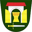
Tymákov
| Tymákov | ||||
|---|---|---|---|---|
|
||||
| Basic data | ||||
| State : |
|
|||
| Region : | Plzeňský kraj | |||
| District : | Plzeň-město | |||
| Area : | 920 ha | |||
| Geographic location : | 49 ° 43 ' N , 13 ° 31' E | |||
| Height: | 398 m nm | |||
| Residents : | 1,024 (Jan 1, 2019) | |||
| Postal code : | 332 01 | |||
| structure | ||||
| Status: | local community | |||
| Districts: | 1 | |||
| administration | ||||
| Mayor : | Václav Špilar (as of 2007) | |||
| Address: | Tymákov 40 33201 Tymákov |
|||
| Municipality number: | 558460 | |||
| Website : | www.tymakov.cz | |||
Tymákov (German Timakow ) is a municipality with 667 inhabitants in the Czech Republic . It is located nine kilometers southeast of the city center of Pilsen and belongs to the Okres Plzeň-město . The cadastral area is 920 ha.
geography
The place is located in the valley of the Tymákovský potok at 398 m above sea level. M. and is surrounded by hills and forests. In the southeast, Tymákov has merged with Mokrouše . To the north of Tymákov runs the route of the D 5 / European route 50, the village can be reached directly from exit 67 / Ejpovice .
Neighboring towns are Ejpovice and Kyšice in the north, Rokycany in the east, Mokrouše in the south-east, Lhůta in the south, Sedlec and Starý Plzenec in the south-west and Letkov in the north-west.
history
The first written mention of Timakov villa comes from 1379. Until the 15th century, the owners of the village changed several times. The first verifiable owner, Jenec z Čachrova, sold the village to the Prague Cathedral Chapter in 1412. In 1417 Bohuslav von Schwanberg bought it together with Cháchov and Mokrouše and three years later Bohuslav von Riesenberg was named as the owner. This was followed by the z Hrádku, the city of Rokytzan and in 1543 Sebastian Markwart was the master of Timakow, Radonicz, Chrachow and Mokrusch , who had to replace the cathedral chapter. Between Timakov and Rokytzan, fighting between the Strakonitzer Union and the troops of Georg von Podebrads took place in the second half of the 15th century . Since the Thirty Years' War, which brought severe devastation, Timakov belonged to Rokytzan.
After the war the depopulated place was settled again, the village Cháchov near Lhota remained desolate. In 1778 a village school was founded. With the replacement of patrimonial Tymákow became an independent municipality in 1850. In the 19th century, many local men worked in the Sedletz b. Starý Plzenec .
During the Second World War, the number of inhabitants rose to 1,145 due to the evacuation of neighboring towns and the relocation of war-essential production. On May 6, 1945, the 3rd US Army marched in under General Patton . In 1977 a culture house was built. Tymákov belonged to the Okres Plzeň-jih until December 31, 2006 .
Community structure
No districts are shown for the municipality of Tymákov.
Attractions
- Chapel on the village square
- Homesteads with historic gates in the Bohemian peasant baroque
Web links
Individual evidence
- ↑ Český statistický úřad - The population of the Czech municipalities as of January 1, 2019 (PDF; 7.4 MiB)

