Uglich reservoir
| Uglich reservoir Угличское водохранилище |
|||||||||
|---|---|---|---|---|---|---|---|---|---|
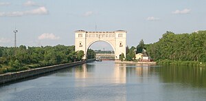
| Lock seen from the Uglich reservoir | |||||||||
|
|||||||||
|
|
|||||||||
| Coordinates | 57 ° 22 '14 " N , 38 ° 6' 2" E | ||||||||
| Data on the structure | |||||||||
| Lock type: | Earthfill dam | ||||||||
| Construction time: | -1940 | ||||||||
| Height of the barrier structure : | 27 m | ||||||||
| Building volume: | 1 540 000 m³ | ||||||||
| Crown length: | 314 m | ||||||||
| Crown width: | 25 m | ||||||||
| Power plant output: | 110 MW | ||||||||
| Data on the reservoir | |||||||||
| Altitude (at congestion destination ) | 113 m | ||||||||
| Water surface | 249 km² | ||||||||
| Storage space | 1.2 billion m³ | ||||||||
| Catchment area | 60 000 km² | ||||||||
The Uglich Reservoir ( Russian: Угличское водохранилище ) is a reservoir on the Volga in Russia ( Europe ). It is part of the so-called Volga-Kama Cascade and was created in 1940.
The reservoir , which is 143 km long and 5 km wide , with a maximum storage volume of 1.20 billion m³ of water and an area of 249 km², is located between Uglich and Dubna , around 150 km (as the crow flies ) north of Moscow . The water level is usually 113 m above sea level.
The three historical cities of Kimry , Kalyasin and Uglich are located on the reservoir , which, like the entire area on the Upper Volga, were important for the development and formation of the Russian nation, statehood and culture.
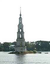
While in Kimry only shallow bank meadows were flooded when the lake was dammed, Kalyasin at the mouth of the Shabnja was partially flooded and divided. 530 of the then 1300 houses were in the flood plain. The wooden houses were dismantled and rebuilt elsewhere, 120 stone buildings were destroyed. The district on the left of the Volga with two churches disappeared completely, and the Nikolaikirche on the right of the Volga also fell victim to the water. Only its former bell tower (built in 1801) protrudes from the water today. In Uglich itself, the entire Malaja storona (Lesser Town) district had to be relocated to the left of the Volga. Kaschiner Strasse, the main street of this district, was located in the axis of the lock canal. Today this road is a few hundred meters further in the direction of the left Volgan tributary Koroshetschna .
For the earth embankment dam ( ⊙ ), which was built by 1940 and is 314 m long, 27 m high and 25 m wide, 1.54 million m³ of earth were used and a core seal made of steel sheet piling was installed. A 179 m long weir system for flood relief was integrated into the dam, whereby the river banks below the weir were fortified with concrete walls up to 4 m thick.
The installed capacity of the hydropower plant is 110 MW. Two turbine sets contributed to a relatively stable electrical energy supply in Moscow during the German-Soviet War ( World War II ).
The ships can go up or down the river through a one-chamber lock, which is 290 m long, 30 m wide and 5.5 m deep. A height difference of 11 meters is overcome during the lock.
See also
- List of the largest dams on earth
- List of the largest reservoirs on earth
- List of the largest hydroelectric plants in the world
- List of dams in the world
Web links
Individual evidence
- ↑ Article Uglich Reservoir in the Great Soviet Encyclopedia (BSE) , 3rd edition 1969–1978 (Russian)
- ↑ Uglich Reservoir in the State Water Directory of the Russian Federation (Russian)


