Valleraugue
| Valleraugue | ||
|---|---|---|

|
|
|
| local community | Val d'Aigoual | |
| region | Occitania | |
| Department | Gard | |
| Arrondissement | Le Vigan | |
| Coordinates | 44 ° 5 ' N , 3 ° 39' E | |
| Post Code | 30570 | |
| Former INSEE code | 30339 | |
| Incorporation | 1st January 2019 | |
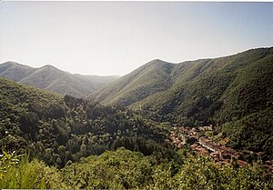
 Valleraugue is located on the upper reaches of the Hérault River |
||
Valleraugue is a village in the French commune of Val-d'Aigoual and a former municipality with the last 1,061 inhabitants (as of January 1, 2016) in the Gard department in the Occitanie region .
The municipality of Valleraugue merged with Notre-Dame-de-la-Rouvière on January 1, 2019 to form the Commune nouvelle Val-d'Aigoual. She belonged to the community association Communauté de communes Causses Aigoual Cévennes .
geography
The river Hérault has its source in the former municipality of Valleraugue . The Mont Aigoual massif is north of the village. The Prat Peyrot winter sports center is located on the territory of the former municipality.
Population development
| year | 1962 | 1968 | 1975 | 1982 | 1990 | 1999 | 2007 | 2016 |
| Residents | 1047 | 1017 | 1028 | 1041 | 1091 | 1009 | 1061 | 1061 |
| Sources: Cassini and INSEE | ||||||||
Personalities
- Laurent Angliviel de La Beaumelle (1726–1773), writer
- Johann d'Arnal (1729–1793), engineer and military
- Étienne d'Arnal (1733–1801), clergyman, engineer and inventor
- Jean Louis Armand de Quatrefages de Bréau (1810-1892), zoologist and anthropologist
- François Perrier (1833–1888), general and geodesist
- Charles Berthézenne (1871–1942), politician
- Germaine Dieterlen (1903-1999), ethnologist
- Francis Cavalier-Bénézet (1922–2014), politician
Web links
Commons : Valleraugue - collection of images, videos and audio files

