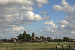
Vianen
 flag |
 coat of arms |
| province |
|
| local community | Vijfheerenlanden |
|
Area - land - water |
42.17 km 2 39.46 km 2 2.71 km 2 |
| Residents | 20,331 (Sep 30, 2018) |
| Coordinates | 52 ° 0 ′ N , 5 ° 6 ′ E |
| Important traffic route |
|
| prefix | 0343 |
| Postcodes | 4130-4132 |
| Website | Homepage of Vianen |
Vianen ( ) was a Dutch municipality in the province of Utrecht .
The municipality included the cities of Vianen and Hagestein and the villages of Everdingen and Zijderveld .
On January 1, 2019, Vianen was merged with Leerdam and Zederik to form the newly formed municipality of Vijfheerenlanden .
Location and economy
Vianen is located in the south of the province, on the Merwede Canal , which crosses the Lek here . The Lekbrücke on the Utrecht - Breda motorway is near Vianen itself ; Two kilometers to the east, near Hagestein, there is another Lek bridge on the Utrecht- 's-Hertogenbosch motorway . These two highways cross near Everdingen, which is two kilometers south of the city of Vianen. At Hagestein there is a dam in the Lek.
Since Vianen is located at a junction of land and waterways, it became the headquarters of many transport companies. Agriculture and tourism are also important.
history
The oldest documented settlement dates from around the year 1000 AD. The original area of the Lords van Arkel (see also: Zederik ), Everdingen, Hagestein, Haaften, Herwijnen, Leerdam and Vianen is called the "Vijfheerenlanden" (Five Lords Lands). In the Middle Ages it belonged to the diocese of Utrecht and now to Holland . Mr. Wilhelm van Duivenvoorde granted Vianen town charter in 1335 . Through a marriage, the Lords of Brederode came into possession of the glory of Vianen in 1414 . It stayed that way, with a brief interruption in the Eighty Years' War , until the family died out around 1680. In 1696, Batenstein Castle , until then the most beautiful building in the city, burned down completely.
Vianen was inherited from Holland in 1725; after the French period (1789-1815) it came to the province of South Holland . On January 1, 2002, Vianen passed to the province of Utrecht by a resolution of the States General .
On January 1, 2019, Vianen was merged with Leerdam and Zederik to form the newly formed municipality of Vijfheerenlanden .
Attractions
Vianen has kept some beautiful buildings in the city center:
- the Lektor, an old city gate;
- the town hall, built in the 15th century, with a local museum;
- the Grote Kerk (Great Church) from the 15th century, a hall church with a longitudinal roof and transverse roofs;
- the neo-Gothic church of Maria ten Hemelopening ( Assumption of Mary ) from the 19th century, a hall church with parallel longitudinal roofs;
- some old houses.
The village of Hagestein has a large campsite, a small lake for swimming and surfing, and a marina.
The polders in the area are suitable for cycling trips.
Web links
- Website of the municipality (Dutch)
Individual evidence
- ↑ Bevolkingsontwikkeling; regio per maand . In: StatLine . Centraal Bureau voor de Statistiek , accessed January 1, 2019 (Dutch)


