Wagensteigbach
| Wagensteigbach | ||
| Water code | DE : 233882 | |
| location | Baden-Wuerttemberg , Germany | |
| River system | Rhine | |
| Drain over | Dreisam → Elz → Rhine → North Sea | |
| source | At St. Märgen | |
| Source height | approx. 1015 m above sea level NN | |
| confluence | with the left Rotbach to Dreisam near Kirchzarten Coordinates: 47 ° 58 '27 " N , 7 ° 57' 38" E 47 ° 58 '27 " N , 7 ° 57' 38" E |
|
| Mouth height | approx. 377 m above sea level NN | |
| Height difference | approx. 638 m | |
| Bottom slope | approx. 37 ‰ | |
| length | 17.4 km | |
| Catchment area | 71.7 km² | |
| Discharge at the Wiesneck A Eo gauge : 49.7 km² |
NNQ MNQ 1946-1994 MQ 1946-1994 Mq 1946-1994 MHQ 1946-1994 HHQ |
10 l / s 110 l / s 1.17 m³ / s 23.5 l / (s km²) 13.27 m³ / s 24.6 m³ / s |
| Discharge at the mouth of the A Eo : 71.7 km² |
MQ Mq |
1.68 m³ / s 23.4 l / (s km²) |
| Communities | St. Märgen , Buchenbach , Kirchzarten , Stegen | |
|
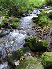
The Wagensteigbach before the confluence with the Rotbach (from left) to the Dreisam |
||
The Wagensteigbach is the 17.4 km long, right and northern source river of the Dreisam in the Middle Black Forest ( Baden-Württemberg , Germany ).
course
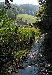
The Wagensteigbach rises as Erlenbach in the Southern Black Forest Nature Park in the municipality of St. Märgen in the area of the historic mountain crossing between Hohle Graben and Turner . The highest source is at an altitude of 1015 m above sea level. NN at the Christenmartinshof. The valley gradually sinks into the southern part of the grassland-rich plateau around St. Märgen and is forested on the steeper slopes. From the hamlet of Holzschlag, the stream is called the Holzschlagbach . South of St. Märgen, the L 128 serpentines the valley floor of the Wagensteig valley, which has a depth of around 250 meters. From the confluence of the Schweigbrunnenbach, the stream takes on the name Wagensteigbach . From then on, the Wagensteigbach flows in a south-westerly direction through Wagensteig (northeastern part of the municipality of Buchenbach). The tributaries Spirzenbach (with the Freiburg - Furtwangen road ), Griesdobelbach and Diezendobelbach flow in rapid succession from the east, running in steep and narrow valleys .
From Buchenbach occurs the Wagensteigbach at an altitude of 450 m above sea level. NN into the Zartener Basin and turns to the northwest. Here it is pushed to the northern edge by the large alluvial fan of the Rotbach and then takes near the Buchenbacher district Wiesneck , at approx. 415 m above sea level. NN , its largest tributary , the Ibenbach coming from the northeast , whose source is between St. Märgen and St. Peter .
After the Wagensteigbach has passed the northern outskirts of Burg (eastern part of the municipality of Kirchzarten), it joins between the center of Kirchzarten and the Stegen district of Unterbirken near the bridge of the L 127 at 377 m above sea level. NN with the Rotbach to Dreisam .
Surname
The other way around than usual, the river at Wagensteigbach is named after the valley, the Wagensteige , which used to be an important crossing over the Black Forest until the road through the Höllental , today's B 31 , could be better developed.
Individual evidence
- ↑ a b Digital topographic map
- ↑ a b c LUBW data and map service
- ↑ Note: Area discharge of the Wiesneck gauge based on the entire catchment area
- ↑ This southwestern part of the Middle Black Forest is often seen as part of the Upper Black Forest, which extends beyond the area of the southern Black Forest .
- ↑ This source load is hydrologically the main source load. The length of the Wagensteigbach creek specified in the map service of the State Agency for the Environment ( LUBW ) refers to him.


