Walle (Aurich)
|
Walle
City of Aurich
|
|
|---|---|
| Coordinates: 53 ° 28 ′ 41 ″ N , 7 ° 26 ′ 36 ″ E | |
| Height : | 5 m |
| Area : | 8.26 km² |
| Residents : | 2567 (Jun. 30, 2008) |
| Population density : | 311 inhabitants / km² |
| Incorporation : | July 1, 1972 |
| Postal code : | 26607 |
| Area code : | 04941 |
|
Location of Walle in the Aurich city area
|
|
Walle is a district of the district town of Aurich in the Aurich district in East Friesland , Lower Saxony .
history
The place Walle was founded in 1534. It got its name because it is located in the middle of a rampart landscape typical of East Friesland.
In 1805 Walle had 147 inhabitants, in 2005 there were 2550.
On July 1, 1972, Walle was incorporated into the city of Aurich.
politics
Walle has a seven-member local council.
Local mayor is Monika Gronewold (CDU).
Culture and sights
- The Evangelical Lutheran Church of St. Luke with windows by Norbert Marten is located in Walle .
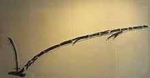
- The Walle plow was found there in 1927. It is the oldest plow found in Europe to date. Initially in the 4th millennium BC, later (in the 1950s) in the late Neolithic Age (around 2000 BC), recent measurements date the plow to the early Bronze Age (1940 to 1510 BC). , which indicates an early settlement of the local area. The original is in the Lower Saxony State Museum in Hanover . A replica can be viewed in the Aurich Historical Museum . A memorial stone has stood at the place where the plow was found (Kreisstraße 138) since December 10, 1975.
Infrastructure
The district of Walle is on the Abelitz – Aurich railway line . Freight traffic has been taking place on the formerly disused railway line since April 2008. A reactivation for local rail passenger transport is required, and the railway line to Jever is to be extended to enable a connection to the East Frisian Coast Railway (RB59).
In 2015, Enercon announced that the company no longer needed to widen the route to transport its products. This also stopped the reactivation of passenger traffic on the Aurich-Emden route.
There is a primary school in the village.
Individual evidence
- ^ Federal Statistical Office (ed.): Historical municipality directory for the Federal Republic of Germany. Name, border and key number changes in municipalities, counties and administrative districts from May 27, 1970 to December 31, 1982 . W. Kohlhammer GmbH, Stuttgart / Mainz 1983, ISBN 3-17-003263-1 , p. 261 .
- ↑ Ortsrat Walle ( page no longer available , search in web archives ) Info: The link was automatically marked as defective. Please check the link according to the instructions and then remove this notice.
- ↑ Dirk Hecht: The cord ceramic settlement system in southern Central Europe. A study on a neglected genus of finds in the transition from the Neolithic to the Bronze Age (PDF; 34.2 MB). Dissertation. Heidelberg 2007. p. 197.
- ↑ Enercon stops railway expansion. Retrieved August 9, 2017 .


