
Wannengrat (Davos)
| Tub ridge | ||
|---|---|---|
 Wannengrat, taken from the Latschüelfurgga |
||
| height | 2517 m above sea level M. | |
| location | Canton of Graubünden , Switzerland | |
| Mountains | Plural pen | |
| Dominance | 0.626 km → Chörbsch Horn | |
| Notch height | 65 m ↓ ridge between Wannengrat and Chörbsch Horn | |
| Coordinates | 778 605 / 185745 | |
|
||

The Wannengrat is a mountain west of Davos in the canton of Graubünden in Switzerland with a height of 2517 m above sea level. M. The proximity to the ski area Schatzalp / Strela he is a popular, easy to be reached ski destination.
Location and surroundings
The Wannengrat belongs to the Strela chain , a subgroup of the plural pen . It is located entirely in the municipality of Davos . Since it lies on the watershed between Plessur and Landwasser , it is geographically part of the Schanfigg, like the Chörbsch Horn . The Wannengrat is bordered in the west by the Hinter Latschüel, in the northeast by the Chilcher Berg and in the southeast by the Tirmet.
The neighboring peaks include the Chüpfenflue and the Strela in the north, as well as Grüenihorn , Hanengretji . Chörbsch Horn and Mederger Flue in the south.
The valley locations are Davos and Langwies . Frequent starting points are the Strela Pass (in winter) and the Schatzalp .
Routes to the summit
Summer routes
About Latschüelfurgga and the northwest side
- Starting point: Davos ( 1560 m ), Schatzalp ( 1861 m ), Stn. Höhenweg ( 2218 m ) or Weissfluhjoch ( 2693 m )
- Via: Latschüelfurgga following the hiking trail to Chörbsch Horn , then over the barren grassy slope to the highest point
- Difficulty: B
- Time required: 3½ hours from Davos, 2½ hours from Schatzalp, 2¼ hours from the Stn. Höhenweg, 2 hours from Weissfluhjoch and 20 minutes from Latschüelfurgga
- Note: For routes to Latschüelfurgga see the article Latschüelfurgga
Via the Potestatenalp
- Starting point: Davos ( 1560 m ) or Schatzalp ( 1861 m )
- Via: Chilcher Bannwald, Lochalp ( 2003 m ), then over the east ridge
- Difficulty: B
- Time required: 2¾ hours from Davos or 1¾ hours from Schatzalp
About the Chörbsch Horn
- Starting point: Davos Frauenkirch ( 1507 m ) or Arosa ( 1739 m )
- From Frauenkirch via Stafelalp ( 1894 m ), P. 2457, Chörbsch Horn ( 2651 m ), P. 2452, southeast ridge
- From Arosa to the Isel reservoir ( 1606 m ), then via Furggaalp ( 1689 m ), Tieja ( 2011 m ), Schwifurgga ( 2519 m ), Chörbsch Horn ( 2651 m ), P.2452, southeast ridge
- Difficulty: B
- Time required:
- 3½ hours from Frauenkirch
- 4 hours from Arosa
Winter routes
From the Schatzalp
- Starting point: Schatzalp ( 1861 m ) or Strelapass mountain station ( 2352 m )
- Via: Strelasee, Latschüelfurgga
- Exposures: S, SE, NW
- Difficulty: WS-
- Time required: 2¾ hours from Schatzalp, 1 hour from the Strelapass mountain station
Departure via Tirmet to Davos Platz
- Destination: Davos ( 1560 m )
- Via: Tirmet, at an altitude curve of 2000 m to E (not too deep into the Albertitobel), forest aisle, Thurgauer Schaffhauser Höhenklinik
- Exposures: SE
- Difficulty: ZS-
- Alternative: You can also drive over the east ridge to Lochalp ( 2003 m ). In the upper area you have to avoid the steep north-east or south-east slopes or walk 25 meters in altitude .
- Note: In the narrow forest aisle, good ski control is required.
panorama

gallery

View to the south to Hanengretji and behind it the Bergüner sticks with Piz Ela , Tinzenhorn and Piz Mitgel .

View north to Chüpfenflue (left) and Strela (right).

Strong zoom to the Weissfluhjoch .
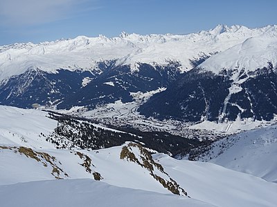
View into the valley to Davos .


literature
- Manfred Hunziker: Ringelspitz / Arosa / Rätikon , Alpine Tours / Bündner Alpen , Verlag des SAC 2010, ISBN 978-3-85902-313-0 .
- Bernard Condrau, Manfred Hunziker: Club guide, Bündner Alpen, Volume I (Tamina and Plessur Mountains). 4th edition. Verlag des SAC, 1988, ISBN 3-85902-048-X , p. 284.
- Vital Eggenberger: Ski touring North Grisons. Verlag des SAC, 2008, ISBN 978-3-85902-270-6 , pp. 153-154 (Chörbsch Horn).
- National map of Switzerland, sheet 1197 Davos, 1: 25000, Federal Office of Topography, 2011 edition.
- National map of Switzerland, sheet 248S Prättigau, 1: 25000, Federal Office of Topography, 2012 edition.