
Tinzenhorn
| Tinzenhorn | ||
|---|---|---|
 Tinzenhorn from the southwest (west face, west ridge, south face) |
||
| height | 3173 m above sea level M. | |
| location | Canton of Graubünden , Switzerland | |
| Mountains | Albula Alps | |
| Dominance | 3 km → Piz Ela | |
| Notch height | 474 m ↓ pass digls Orgels | |
| Coordinates | 771 003 / 164 679 | |
|
||
| rock | dolomite | |
| First ascent | August 7, 1866 by Douglas William Freshfield, François Devoussoud and E. Hauser with Peter Jenny and Alex Flury | |
| Normal way | North-east face of Elahütte and west ridge of Oberhalbstein | |
| particularities | Find fossilized dinosaur footprints from the Triassic period | |
 Bergüner sticks with Piz Mitgel , Tinzenhorn and Piz Ela (from left to right), taken from Val Schmorras , Oberhalbsteiner side. |
||
.jpg) Bergüner sticks with Piz Ela , Tinzenhorn and Piz Mitgel (from left to right), taken from Dorfberg (via Davos). |
||

The Tinzenhorn ( Rhaeto-Romanic Corn da Tinizong , in the local idiom Surmiran Corn da Tinizung ) is a mountain east of Savognin and southwest of Filisur in the canton of Graubünden in Switzerland with an altitude of 3,173 m . Petrified dinosaur footprints were found on the Tinzenhorn . It is a slender, boldly soaring spire of almost Gothic appearance, the four walls of which fall into partially torn walls.
Location and surroundings
The Tinzenhorn belongs to the Bergüner sticks , a subgroup of the Albula Alps . The Tinzenhorn separates the Albula Valley in the north from the Oberhalbstein in the southwest . The summit is in the municipality of Bergün Filisur , but the municipality border with Surses is only 191 m away.
The neighboring peaks of the Tinzenhorn include Piz Mitgel , Piz Ela and Pizza Grossa .
At the foot of the Tinzenhorn there is the often visited mountain lake Lai Tigiel ( 2462 m ) and the digls Orgels pass ( 2699 m ), with its pointed, narrow and partly perforated dolomite gendarmes, which are reminiscent of the organ pipes of a church organ. Both the Lai Tigiel and the digls Orgels pass can be easily reached on a good and well-marked hiking trail.
The mountain lies in the middle of Parc Ela , a 600 square kilometer nature park opened in 2006 .
Valley locations are Savognin and Tinizong in Oberhalbstein, as well as Filisur and Bergün in the Albula valley. Starting points are the Ela hut in the lonely Val Spadlatscha and the Alp Plang la Curvanera, which can be reached via a narrow alpine road .
Fossil finds

Petrified dinosaur footprints were found on the Tinzenhorn . The traces come from sauropods from the Triassic period , when the rocks were still at sea level 200 to 210 million years ago. The tracks are considered to be the oldest such evidence in the world.
The Tinzenhorn in art

In many of the landscape paintings by the expressionist painter Ernst Ludwig Kirchner , who lived and worked in Davos with interruptions from 1917, the Tinzenhorn occupies an important position. The Tinzenhorn - Zügenschlucht near Monstein work from 1919/20 is dedicated to this mountain.
Routes to the summit
Frequent starting points are the Ela hut and Plang la Curvanera. A little road from Savognin via Tussagn leads to the Plang la Curvanera car park ( 1893 m above sea level ) . The alpine road from Tinizong into the Val d'Err to Penza is closed to general motor vehicle traffic. A hiking bus runs from Savognin to Plang la Curvanera on Wednesdays and to Pensa on Tuesdays and Fridays.
Through the northeast face
Normal route from the Ela hut, route of the first to climb
- Starting point: Elahütte ( 2252 m )
- Difficulty: WS
- Time required: 3–4 hours
South ridge
Panoramica
- Starting point: Elahütte ( 2252 m ) or Plang la Curvanera ( 1793 m )
- Difficulty: SS
- Time required: 3-4 hours from entry
Through the south wall
Wenceslas Route
- Starting point: Elahütte ( 2252 m ) or Plang la Curvanera ( 1793 m )
- Difficulty: S
- Time required: 3-4 hours from entry
Direct south wall
- Starting point: Elahütte ( 2252 m ) or Plang la Curvanera ( 1793 m )
- Difficulty: SS
- Time required: 4½-6 hours from entry
Fogliaroute
- Starting point: Elahütte ( 2252 m ) or Plang la Curvanera ( 1793 m )
- Difficulty: AS-
- Time required: 6–8 hours from entry
Laura & Enrico
- Starting point: Elahütte ( 2252 m ) or Plang la Curvanera ( 1793 m )
- Difficulty: EX
- Time required: 6–8 hours from entry
Over the west ridge
Normal route from the Oberhalbstein
- Starting point: Plang la Curvanera ( 1793 m ), Tinizong ( 1232 m ) or Savognin ( 1206 m )
- Difficulty: ZS
- Time required: 2½-3 hours from the entry saddle, 5½-6½ hours from Plang la Curvanera or 6½-7½ hours from the valley
Through the north wall
Ridge route
- Starting point: Elahütte ( 2252 m )
- Difficulty: ZS
- Time required: 6 hours

panorama

gallery

Panorama Bergünerstocks and Err area

Climbers on the Tinzenhorn
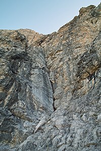
Climbing route on the Tinzenhorn

Pass digls Orgels recorded from below Tinzenhorn

Piz Mitgel and Tinzenhorn from the southeast ( Piz Val Lunga ).


literature
- Eugen Wenzel, Paul Gross: Club Guide, Bündner Alpen, Volume VI (Albula) 2nd edition. Verlag des SAC, 1980, ISBN 3-85902-012-9 , pp. 136-142.
Web links
- Tinzenhorn on the ETHorama platform
- Panorama from the Tinzenhorn (gipfelderschweiz.ch) ( Memento from August 19, 2006 in the Internet Archive )
- Climbing routes on the Tinzenhorn (hotelswiss.com) ( Memento from October 5, 2013 in the Internet Archive )
- Various tour reports (hikr.org)
Individual evidence
- ↑ swissinfo ; Retrieved September 3, 2010.
- ^ Project Dinosaurs grischuns ; Retrieved September 3, 2010.
- ↑ Bike & hiking bus timetable on the Savognin Bivio Albula holiday region website, accessed on April 8, 2018