Yeşilırmak
|
Yeşilırmak ancient name: Iris |
||
| Data | ||
| location | Amasya , Samsun , Sivas , Tokat ( Turkey ) | |
| River system | Yesilirmak | |
| source |
Yeşilırmak Mountains 40 ° 3 ′ 21 ″ N , 37 ° 41 ′ 54 ″ E |
|
| Source height | approx. 1750 m | |
| muzzle | north of Çarşamba into the Black Sea Coordinates: 41 ° 22 ′ 54 ″ N , 36 ° 39 ′ 37 ″ E 41 ° 22 ′ 54 ″ N , 36 ° 39 ′ 37 ″ E |
|
| Mouth height | 0 m | |
| Height difference | approx. 1750 m | |
| Bottom slope | approx. 3.4 ‰ | |
| length | 519 km | |
| Catchment area | 36,100 km² | |
| Drain |
MQ |
121 m³ / s |
| Left tributaries | Çekerek Çayı , Tersakan Çayı | |
| Right tributaries | Kelkit Çayı | |
| Reservoirs flowed through |
Almus dam , Ataköy dam , Hasan-Uğurlu dam , Suat-Uğurlu dam , Kumköy dam |
|
| Big cities | Amasya , Tokat | |
| Medium-sized cities | Çarşamba , Turhal | |
| Small towns | Taşova | |
| Communities | Şerefiye | |
| Residents in the catchment area | 3,000,000 | |
|
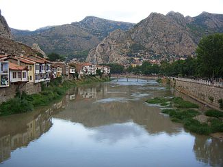
Yeşilırmak in Amasya |
||
The Yeşilırmak (literally "Green River") is a river in northern Turkey .
The Hittite name is probably Zulija , the ancient Greek name is Ίρις ( iris ).
The Yeşilırmak rises in the Yeşilırmak Mountains south of the village of Şerefiye in the Sivas province . In the upper reaches it flows in a predominantly west-northwest direction through the mountains. It flows parallel to the Kelkit Çayı , which runs further to the north and meets it in the lower reaches. The Yeşilırmak is dammed in the upper reaches of the Almus dam . Below this is the smaller Ataköy dam . The Yeşilırmak later passes through the cities of Tokat and Turhal . Finally he takes the Çekerek Çayı from the left, turns north and flows through the city of Amasya . There the Tersakan Çayı flows from the west into the Yeşilırmak. This then flows a little to the east, past Taşova , to the confluence of the Kelkit Çayı. Now it cuts through the Canik Dağları mountain range of the Pontic Mountains in a northerly direction. The two dams Hasan-Uğurlu and Suat-Uğurlu are located on this section of the river. Finally, the Yeşilırmak reaches the coastal plain east of Samsun . It passes the city of Çarşamba before it flows into the Black Sea in the Çarşamba Delta . The provinces of Sivas, Tokat , Amasya and Samsun lie on the course of the river . Yeşilırmak is 519 km long. Its catchment area covers 36,100 km². The mean discharge is 121 m³ / s. The highest discharge measured so far is 1914 m³ / s, while the lowest is 1.83 m³ / s.
Web links
Individual evidence
- ↑ a b c d e DSI: River Basin Management Applications: Yesilirmak River Basin Development Project Model (PDF)
- ↑ Article Yeşilırmak in the Great Soviet Encyclopedia (BSE) , 3rd edition 1969–1978 (Russian)
- ↑ Kaspar K. Riemschneider, Hittite fragments of historical content from the time of Hattušilis III. Journal of Cuneiform Studies 16/4, 1962, 113

