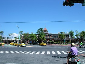
Yilan (city in Taiwan)
|
Yilan 宜蘭 市 |
||
 Yilan Railway Station |
||
| State : |
|
|
| County : | Yilan | |
| Coordinates : | 24 ° 45 ′ N , 121 ° 45 ′ E | |
| Height : | 5 m | |
| Area : | 29.40 km² | |
| Residents : | 96,268 (August 2013) | |
| Population density : | 3,274 inhabitants per km² | |
| Time zone : | UTC + 8 (Chungyuan time) | |
| ISO 3166-2 : | TW-ILA | |
| Website : | ||
|
|
||
Yilan , also: Ilan ( Chinese 宜蘭 市 , Pinyin Yílán Shì , W.-G. I 2 -lan 2 Shih 4 , Pe̍h-ōe-jī Gî-lân-chhī ), is the capital of Yilan County in Taiwan . It is located in a small coastal plain , mainly used for rice cultivation, in the estuary of the Lanyang River in the northern part of Taiwan's east coast, around 80 km southeast of Taipei .
The city has about 96,000 inhabitants and an area of 29.40 km². The name Yilan comes from the Kavalan tribes of the Taiwanese indigenous people .
climate
| Yilan | ||||||||||||||||||||||||||||||||||||||||||||||||
|---|---|---|---|---|---|---|---|---|---|---|---|---|---|---|---|---|---|---|---|---|---|---|---|---|---|---|---|---|---|---|---|---|---|---|---|---|---|---|---|---|---|---|---|---|---|---|---|---|
| Climate diagram | ||||||||||||||||||||||||||||||||||||||||||||||||
| ||||||||||||||||||||||||||||||||||||||||||||||||
|
Climate data from the years 1981–2010
Source: Taiwan Central Weather Bureau
|
||||||||||||||||||||||||||||||||||||||||||||||||||||||||||||||||||||||||||||||||||||||||||||||||||||||||||||||||||||||||||||||||||||||||||||||||||||||
Web links
Individual evidence

