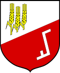
Złotów (rural municipality)
| Gmina Złotów | ||
|---|---|---|

|
|
|
| Basic data | ||
| State : | Poland | |
| Voivodeship : | Greater Poland | |
| Powiat : | Złotów | |
| Geographic location : | 53 ° 22 ' N , 17 ° 2' E | |
| Residents : | see Gmina | |
| Telephone code : | (+48) 67 | |
| License plate : | PZL | |
| Economy and Transport | ||
| Rail route : | Chojnice – Piła | |
| Gmina | ||
| Gminatype: | Rural community | |
| Gmina structure: | 45 villages | |
| 27 school authorities | ||
| Surface: | 292.50 km² | |
| Residents: | 9940 (June 30, 2019) |
|
| Population density : | 34 inhabitants / km² | |
| Community number ( GUS ): | 3031082 | |
| administration | ||
| Mayor : | Kazimierz Trela | |
| Address: | ul. Leśna 7 77-400 Złotów |
|
| Website : | www.gminazlotow.pl | |
The Gmina Złotów is a Polish rural municipality that has its official seat in the city of Złotów , although the city itself is not part of the municipality. The municipality is assigned to the powiat Złotowski and has belonged to the Greater Poland Voivodeship since 1998 , until then to the Piła Voivodeship . The municipality covers an area of 292.5 km², which corresponds to 17.61% of the total area of the Powiat Złotowski and has 9,000 inhabitants.
geography
The municipality completely surrounds the town of Złotów . The eastern municipal boundary is identical to the dividing line between Germany and Poland that existed between 1920 and 1939 (see Polish Corridor ). The municipality is crossed by smaller rivers, including the Glomia (Glumia) , Skicka Struga (Kietzer Bach) and the Śmiardówka (Katzenbach) .
The neighboring communities of Gmina Złotów are: The city of Złotów and the communities Jastrowie (Jastrow) , Krajenka (Krojanke) , Lipka (Linde) , Łobżenica (Lobens) , Okonek (Ratzebuhr) , Tarnówka (Tarnowke) , Wysoka (Wisseck / Weisseck) and Zakrzewo (bush village) .
Community structure
The rural community Złotów includes 45 localities, which are assigned to 27 districts (" Schulzenämter ").
- Districts :
|
|
Others towns : Bługowiec, Gajek, Grodno ( Bergelau ) Kaczochy ( Karlshof ) Kleszczynka ( Wilhelmsee ) Kobylnik ( Kobilnik ) Krzywa Wieś-Leśniczówka ( Krummengließ Forest ), Łopienko ( Buhental ) Nowa Kleszczyna ( New Kleschin ) Nowa Święta-Leśniczkówka ( New Schwente Forest ), Nowa Święta-Osada ( New Schwente settlement ), Nowiny-Osada ( Bruchhof settlement ), Pieczyn ( Louisenhof ), Rosochy ( Roßochen ), Sławianówko ( Slawianowko ), Stawnicki Młyn, Stawnicki Młyn., Stawnicki Młyn Wielatowo ( Lindenhof ).
Personality from the municipality
Blankwitt , now Polish Blęwit
- Herbert Pankau (* 1941), German soccer player
Web links
- Official website of Gmina (Polish)
Footnotes
- ↑ population. Size and Structure by Territorial Division. As of June 30, 2019. Główny Urząd Statystyczny (GUS) (PDF files; 0.99 MiB), accessed December 24, 2019 .
- ^ Name change according to www.westpreußen.de , change of the station name according to www.hs-merseburg.de on April 1, 1929

