Zwiesel (Chiemgau Alps)
| Zwiesel | ||
|---|---|---|
|
The Staufen seen from the aircraft from the northeast |
||
| height | 1781.6 m above sea level NHN | |
| location | between Bad Reichenhall and Inzell ; Districts of Berchtesgadener Land and Traunstein , Bavaria ( Germany ) | |
| Mountains | Chiemgau Alps | |
| Dominance | 11.7 km → Sonntagshorn | |
| Notch height | 1073 m ↓ Zwing | |
| Coordinates | 47 ° 45 '20 " N , 12 ° 48' 51" E | |
|
|
||
| Normal way | Jochberg - Zwieselalm - Zwiesel | |
The Zwiesel is 1781.6 m above sea level. NHN the highest mountain of the Staufen massif . It is located between Bad Reichenhall and Inzell in the Bavarian districts of Berchtesgadener Land and Traunstein .
Together with Gamsknogel ( 1750 m ) and Zennokopf ( 1756 m ) it is also known as Hinterstaufen (see Fuderheuberg - Vorderstaufen).
Geographical location
The Zwiesel rises in the urban and community areas of Bad Reichenhall in the southeast and Schneizlreuth in the south (both district of Berchtesgadener Land) and Inzell in the west-northwest (district of Traunstein), the borders of which collide at the summit. On the northern slope of the mountain, below the Dunklwand at 922 m above sea level, lies the Frillensee , whose small outflow Frillenseebach north-northwest of the mountain feeds the Großwaldbach .
hike
Several marked trails lead from Inzell (Adlgaß), Weißbach (Jochberg) and Bad Reichenhall ( Listsee ) to the summit of the Zwiesel. To get to Hochstaufen, it is possible to cross over the Mittelstaufen (demanding to difficult) or over the Barthlmahd.
Zwieselalm
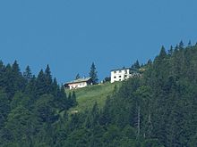
The Zwieselalm with the Kaiser-Wilhelms-Haus mountain hut is located on the southern slope of the Zwiesel at an altitude of around 1380 m . The Alm can be reached on the way from Jochberg and Listsee, for example. The last pack animal kompanie the Bundeswehr provides them in the warm season with food.


