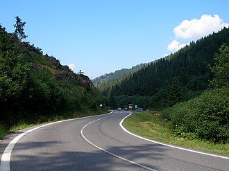
Čertovica
| Čertovica | |||
|---|---|---|---|
|
Pass road over the pass |
|||
| Compass direction | North | south | |
| Pass height | 1232 m nm | ||
| Kraj | Žilinský | Banskobystrický | |
| Watershed | Boca → Waag → Danube | Štiavnička → Hron → Danube | |
| Valley locations | Vyšná Boca | Jarabá | |
| expansion | Street I / 72 | ||
| Mountains | Low Tatras | ||
| particularities | highest passable pass in Slovakia | ||
| Map (Žilinský) | |||
|
|
|||
| Coordinates | 48 ° 54 '20 " N , 19 ° 44' 9" E | ||
The Čertovica ( Hungarian Ördöglakodalma-hágó ) is a mountain pass in the Low Tatras in Slovakia . It connects the upper valleys of Hron on the south side ( Horehronie region ) and Waag on the north side ( Liptov region ). Apart from the border passes in Donovaly and near Vernár , it is the only pass in the main ridge of the Low Tatras and the highest pass in Slovakia.
Geomorphologically, the pass divides the two subdivisions of the Low Tatras: the Ďumbierske Tatry in the west and the Kráľovohorské Tatry in the east. There is a small winter sports area at the top of the pass, but it is also a starting point for activities in summer.
Both the state road I / 72 and the international hiking trail E8 , which is also called the Trail of the Heroes of the Slovak National Uprising ( Cesta hrdinov SNP ), run over the pass .

