Aglasun
| Aglasun | ||||
|
||||
| Basic data | ||||
|---|---|---|---|---|
| Province (il) : | Burdur | |||
| Coordinates : | 37 ° 39 ' N , 30 ° 32' E | |||
| Height : | 1050 m | |||
| Surface: | 305 km² | |||
| Residents : | 4,266 (2018) | |||
| Population density : | 14 inhabitants per km² | |||
| Telephone code : | (+90) 248 | |||
| Postal code : | 15 800 | |||
| License plate : | 15th | |||
| Structure and administration (as of 2019) | ||||
| Structure : | 6 mahall | |||
| Belediye Başkanı: | Ali Ulusoy ( AKP ) | |||
| Postal address : | Çınar Mahallesi, Ataturk Cad. 3 15800 Ağlasun / Burdur |
|||
| Website: | ||||
| Ağlasun County | ||||
| Residents : | 8,537 (2018) | |||
| Surface: | 576 km² | |||
| Population density : | 15 inhabitants per km² | |||
| Kaymakam : | Tanju Çanakcıoğlun | |||
| Website (Kaymakam): | ||||
Ağlasun is a district and a district town in the east of the Turkish province of Burdur .
Surname
Ağlasun is the Ottoman form of the Greek name Agalassos. The name goes back to the Hittite name of a first mountain settlement called Salawassa from the 14th century BC. In ancient Greek ( Koine ) the name was ground to Sagalassos (Greek: Σαγαλασσός ), in Modern Greek to Agalassos (Greek: Αγαλασσός ).
district
The district borders in the north and east on the province of Isparta (central district Isparta , Merkez ), in the west on the central district (Merkez) Burdur , in the southwest on the district Çeltikçi and in the south on the district Bucak .
Two important roads cross the district: The D 685 from Bucak, which leads over the 950 m high Köroğlu Beli Pass to Isparta, and the road from Antalya to Isparta, which grazes the western district. The provincial capital Burdur is 35 km away.
The district, created in 1958, consists of the district town (almost half of the district's population) and nine villages ( Köy ) with an average population of 475 residents:
- Bala
- Derekoy
- Hisarkoy
- Kibrit
- Cum
- Mamak
- Yazır
- Yeşilbaşköy
- Yukarı
Two of these villages have over a thousand inhabitants: Yeşilbaşköy (1,373 inhabitants) and Mamak (1,079 inhabitants). In terms of area, the district is third to last in the province, it is also less populated than this (the population density is therefore lower than the provincial average). The population peaked in 1990 with 11,505. Since then the population rate has been falling continuously. In 2018 there were only 8,500 residents as a result of the rural exodus.
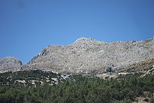
The whole area is over 1,000 m high. In the north of the district there is the Akdağ Mountains, the highest peak of which rises 2,276 m. Only small streams flow through the district, all of which flow into the Tuzlu çay (also: Ağlasun çay ), which pours into the Aksu at the northeastern boundary of the district . The center of the district is the fertile Mamak Plain (Turkish: Mamak ovası ), where sour cherries, walnuts, apples, wheat, corn and roses are cultivated. Two small reservoirs, the Ağlasun baraji and the Hisar baraji , ensure adequate irrigation. There is no industry to speak of, the main employers are agriculture and some tourism in the city of Ağlasun. The state prison in Ağlasun is an important employer.
history
For the history of Ağlasun see under Sagalassos . Between 640 and 700 AD, Sagalassos and other smaller settlements in the valley were abandoned because of the numerous Arab attacks. Only the remains of a fortified monastery from the 10th century were found in the valley; but this was destroyed by the Seljuks in the 12th century. It is known from the 13th century that the Seljuks reactivated the Silk Road from Konya to Antalya and built several rest houses ( han ), none of which have survived. After the collapse of the Rum Seljuk Empire, the principality (Turkish: beylik ) of the Hamidoğulları from Isparta took power. In 1391/92 the Ottoman Sultan Bayezid I conquered the Hamidoğulları Beylik. After Bayezid's defeat against the Mongols under Tamerlane , the Beylik were restored. It was not until 1472 that Sultan Mehmed II was able to place the area permanently under Ottoman rule. In Ottoman records from the years 1500–1501, Ağlasun was mentioned as a subdistrict, which consisted of 9 villages and a municipality. In the 19th century, Ağlasun belonged to the Beylerbey (roughly: province) Konya and the Sanjak Burdur. After the establishment of the Republic of Turkey in 1923, Ağlasun was assigned to the Burdur Province. 1958 Ağlasun was separated from Burdur and became a separate district.
Worth seeing
- A few kilometers north of the district town lie the ruins of the Hellenistic city of Sagalassos on the slope of Akdağ, which belongs to the Taurus Mountains .
- In Ağlasun, on Republic Square, there is an approximately 1,000 year old sycamore with a diameter of 3.30 meters.
Individual evidence
- ↑ Sevan Nişanyan : Adini unutan Ülke. Türkiye'de Adı Değiştirilen Yerler Sözlüğü. Istanbul 2010, p. 82.
- ↑ "1990 genel nüfus sayımı verileri". Türkiye İstatistics Kurumu. 3 Kasım 2012 tarihinde kaynağından (html) arşivlendi. Erişim tarihi: 3 Kasım 2012.
Web links


