A34 road
| A34 road in the UK | |

|
|
| map | |
| Basic data | |
| Operator: | |
| Start of the street: | M3 at Winchester |
| End of street: | Salford near Manchester |
| Overall length: | 251.4 km (156.2 mi ) |
| The Newbury bypass of the A34 (photo 2008) | |
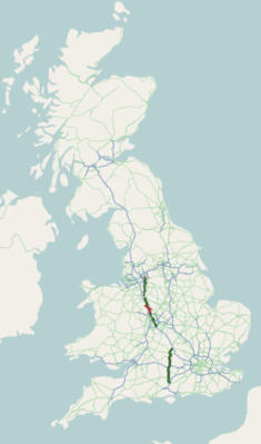
The A34 road ( English for road A34 ) is a 251.4 km long road, which is designated as the primary route for almost its entire length .
course
Southern part
The road begins at Winchester on the M3 motorway , passes Winchester northeast, and then turns north. The dual carriageway crosses the A303 road , bypasses the city of the same name in the west on the Newbury bypass, crosses the A4 road and joins the A339 road north of it . It then crosses the M4 motorway at junction 13 and continues northwards. Here, Abingdon-on-Thames bypassed. This is followed by the western bypass of Oxford , on which the A420 road and the A40 road cross and the A44 road branches off. The A34 continues north-northeast until it meets the M40 motorway at its junction 9 south of Bicester and merges into the A41 road .
Northern part
After a longer break, the A34 starts again at junction 4 of the M42 motorway south of Solihull , runs through Birmingham and leaves the city northwards towards Walsall , crossing the M6 motorway at junction 7. The toll road M6 toll motorway is crossed at junction 17 and the A34 leads west past Cannock to Stafford , where the A518 road is crossed. Via Stone , where the A51 road crosses, it runs east parallel to the M6, crossing the A50 road , through Newcastle-under-Lyme to Kidsgrove and Congleton , where it crosses the A54 road , via Wilmslow to Manchester and from there to the neighboring city Salford , where it ends.


