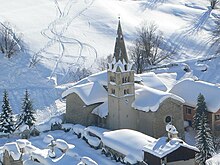
Abriès
| Abriès | ||
|---|---|---|

|
|
|
| local community | Abriès-Ristolas | |
| region | Provence-Alpes-Cote d'Azur | |
| Department | Hautes-Alpes | |
| Arrondissement | Briançon | |
| Coordinates | 44 ° 48 ' N , 6 ° 56' E | |
| Post Code | 05460 | |
| Former INSEE code | 05001 | |
| Incorporation | 1st January 2019 | |
| status | Commune déléguée | |
 Old market hall - today Abriès Tourist Office |
||
Abriès is a village and a former French community with 299 inhabitants (at January 1, 2017) in the Hautes-Alpes in the region of Provence-Alpes-Cote d'Azur . It belonged to the Arrondissement Briançon and the community association Guillestrois et Queyras .
With effect from January 1, 2019, the former municipalities of Abriès and Ristolas were merged to form the Commune nouvelle Abriès-Ristolas and have the status of a Commune déléguée in the new municipality . The administrative headquarters are in Abriès.
geography
The former municipality comprised part of the Cottian Alps , the ridge of which forms the northern and eastern municipal boundaries and the border between France and Italy . The peaks of the Alpine ridge reach heights of 3302 m ( Bric Froid ) and 3293 m ( Grand Glaiza ). The area around Abriès in the Queyras Regional Nature Park is drained by the Guil , which receives numerous mountain streams ( Goulon, Bouchet ).
The districts of La Garcine, Le Roux and Valpreveyre belong to Abriès .
Neighboring towns of Abriès are Sestriere (Italy) in the north, Bobbio Pellice (Italy) in the east, Ristolas in the southeast and Aiguilles in the south and west.
Population development
| year | 1962 | 1968 | 1975 | 1982 | 1990 | 1999 | 2007 | 2017 | |
| Residents | 205 | 195 | 207 | 271 | 297 | 354 | 377 | 299 | |
| Source: Cassini | |||||||||
Attractions
- Church of St. Peter ( Église Saint Pierre )
- Notre-Dame-des-Sept-Douleurs chapel
- Chapelle des Pénitents
- Saint Roch chapel
- Saint-Roch chapel in the Valpreveyre district
Economy and Infrastructure
Twelve farms are located in Abriès (cultivation of grain, vegetables and aromatic plants, breeding of cattle, sheep and goats).
Located in a narrow high alpine valley, Abriès can only be reached from the southwest (via the trunk road from Guillestre, 30 kilometers away ).
supporting documents
- ↑ Decree of the Prefecture No. 05-2018-10-15-005 on the formation of the Commune nouvelle Abriès-Ristolas of October 15, 2018 .
- ↑ Abriès on cassini.ehess.fr
- ↑ Farms on annuaire-mairie.fr (French)
Web links
- Abriès on escartonduqueyras.com (French)


