
Aiguilles
| Aiguilles | ||
|---|---|---|

|
|
|
| region | Provence-Alpes-Cote d'Azur | |
| Department | Hautes-Alpes | |
| Arrondissement | Briançon | |
| Canton | Guillestre | |
| Community association | Guillestrois et Queyras | |
| Coordinates | 44 ° 48 ' N , 6 ° 56' E | |
| height | 1,400-3,078 m | |
| surface | 40.16 km 2 | |
| Residents | 429 (January 1, 2017) | |
| Population density | 11 inhabitants / km 2 | |
| Post Code | 05470 | |
| INSEE code | 05003 | |
 Mairie Aiguilles |
||

Aiguilles is a French municipality with 429 inhabitants (at January 1, 2017) in the Hautes-Alpes in the region d'Provence-Alpes-Cote Azur . It belongs to the Arrondissement Briançon and the community association Guillestrois et Queyras .

geography
The 40 km² community of Aiguilles in Queyras covers a section of the upper Guiltal in the Cottian Alps , not far from the border between France and Italy . Numerous mountain streams ( Torrent-du-Lombard, Torrent-de-Peynin ) flow into the Guil, which flows to the west . The municipality belongs to the Queyras Regional Nature Park .
The mountain foothills lying across the main Alpine ridge reach heights of over 2,400 m around Aiguilles:
These include: north of the Guil Valley
- Petit Rochebrune 3078 m
- La Serre de l'Aigle 2496 m
- Pic du Malrif 2906 m
south of the Guil Valley
- Pic du Fond de Peynin 2912 m
- La Gardiole de l'Alp 2786 m
Aiguilles includes the districts of La Condamine, Peynin, Le Lombard and Les Eygliers .
Neighboring communities of Aiguilles are Cervières in the north, Abriès-Ristolas in the south and in the south-east and Molines-en-Queyras in the south-west and west.
history
Finds from Gallo-Roman times suggest a long history of the place. The wooden houses were very susceptible to fire. Large parts of the village were devastated by fires in 1746 and 1829. After the last major fire, many residents emigrated to South America, especially Argentina, Colombia and Chile. Some of the prosperous families there returned to Aiguilles at the beginning of the 20th century and built magnificent villas.
| year | 1962 | 1968 | 1975 | 1982 | 1990 | 1999 | 2007 | 2017 | |
| Residents | 205 | 195 | 207 | 271 | 297 | 354 | 377 | 429 | |
| Sources: Cassini and INSEE | |||||||||
Attractions
- Parish church of St. John the Baptist ( Église Saint-Jean-Baptiste ) from the 17th century, reconstructed after fire damage in the 19th century
- Sacred Heart Chapel ( Chapelle du Sacré-Cœur ) next to the parish church, formerly belonged to a penitent brotherhood
- Sundial with the inscription "Nihil sine sole" ( Nothing without the sun )
- numerous fountains

Tower of the Johanneskirche
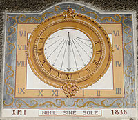
Sundial in Aiguilles


Economy and Infrastructure
There are six farms in the community (growing grain, breeding cattle, sheep and goats). The main line of business in Aiguilles is now the hospitality industry. There are numerous hotels and pensions available for tourists. The main season is winter when the four ski lifts southeast of the village are in operation and the five slopes are groomed.
Aiguilles can be reached from Gap on the A 51 via the Durancetal and the Guiltal . From Briançon the access to Aiguilles leads over the Col Agnel .
supporting documents
- ↑ history www.aiguilles.com. Retrieved March 30, 2013 (French).
- ↑ Aiguilles on cassini.ehess.fr
- ↑ Aiguilles on insee.fr
- ↑ Farms on annuaire-mairie.fr (French)