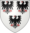
Vars (Hautes-Alpes)
| Vars | ||
|---|---|---|

|
|
|
| region | Provence-Alpes-Cote d'Azur | |
| Department | Hautes-Alpes | |
| Arrondissement | Briançon | |
| Canton | Guillestre | |
| Community association | Guillestrois et Queyras | |
| Coordinates | 44 ° 36 ′ N , 6 ° 41 ′ E | |
| height | 1,320-3,381 m | |
| surface | 92.2 km 2 | |
| Residents | 525 (January 1, 2017) | |
| Population density | 6 inhabitants / km 2 | |
| Post Code | 05560 | |
| INSEE code | 05177 | |
 Vars in winter |
||
Vars is a commune in the Hautes-Alpes in the region of Provence-Alpes-Cote d'Azur . It belongs to the Arrondissement of Briançon and the Canton of Guillestre .
geography
The municipality borders on Ceillac in the northeast, Saint-Paul-sur-Ubaye in the southeast, Crévoux in the southwest , Saint-André-d'Embrun and Risoul in the west and Guillestre in the northwest . The Col de Vars is a 2108 m high mountain pass.
Population development
| year | 1962 | 1968 | 1975 | 1982 | 1990 | 1999 | 2008 | 2012 |
|---|---|---|---|---|---|---|---|---|
| Residents | 245 | 433 | 779 | 897 | 941 | 637 | 606 | 706 |
Importance for sport
The place is known nationwide for its special piste for speed skiing , on which numerous world speed records have already been set. The Chabrière slope with a length of 1.3 km and a gradient of 98 percent at the beginning of the route is located in the La Forêt Blanche ski area .
Web links
Commons : Vars - collection of images, videos and audio files
Individual evidence
- ↑ Speed record in skiing on www.snowplaza, accessed on December 17, 2017.
- ↑ Schmidhofer faster than ever
