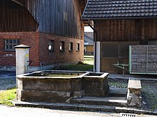
Achmühle (Dornbirn)
| Achmühle | ||
|---|---|---|
|
|
||
| Basic data | ||
| Pole. District , state | Dornbirn (DO), Vorarlberg | |
| Judicial district | Dornbirn | |
| Pole. local community | Dornbirn | |
| Borough | Oberdorf / Hatlerdorf | |
| Coordinates | 47 ° 24 '13 " N , 9 ° 44' 59" E | |
| height | 455 m above sea level A. | |
| Post Code | 6850 Dornbirn | |
| prefix | + 43/5572 ( Dornbirn ) | |
 View from Bürgleweg from Dammstrasse over the Hintereachmühle and Vordereachmühle, Juchen, St.Martin on the left and Oberdorferkirche and Zanzenberg on the right. |
||
| Source: STAT : index of places ; BEV : GEONAM ; VoGIS | ||

Achmühle is a district in the southeastern municipality of the Austrian city of Dornbirn , state of Vorarlberg and is divided into Vorderachmühle and Hinterachmühle.
Origin of name
Achmühle is a field and place name that refers to the mills that used to be located here, which used the water from the Dornbirner Ache to convert mechanical energy. An Achmühle is mentioned as early as 1369 in this area , it burned down in 1581.
history
The earliest evidence of human presence in today's Dornbirn municipality can be dated to the Middle Stone Age (8000 to 3000 BC). This includes a disc-shaped club head made of green-black quartzite that was found in 1971 under the Achmühler Bridge, which connects the Vorderachmühle with the Hinterachmühle, which could be identified as a dagger blade made of bronze and is assigned to the Bronze Age (3000 to 1800 BC) . It is the oldest find in the municipality in Dornbirn, which is still inhabited today.
The Achmühle district has been divided into Vorder- and Hinterachmühle since the quarter division in 1828 and comprises the northeastern part of the settlement area of the Hatlerdorf and Oberdorf district, directly on the banks of the Dornbirner Ach . While the Hinterachmühle is on the southern - that is, Hatler - side of the river, the Vorderachmühle refers to the area on the Oberdorf side of the Ache.
Geography, topography
Achmühle is part of the Hatlerdorf or Oberdorf district in the southeast of the Dornbirn settlement area at an average of 450 m above sea level. A. to about 460 m above sea level. A. and is about 1.5 km as the crow flies from the city center of Dornbirn. It is partly at the foot of the Bürgle or the Zanzenberg .
Transport and economy
The old country road from Hohenems to Haselstauden (via Haslach , Mühlebach, Achmühle, Oberdorf , Steinebach and Kehlen - Römerstraße) has always led via Oberdorf - Vordereachmühle - Hintereachmühle - Mühlebach .
Between 1530 and 1540 a new main road was led from Hohenems over the Wallenmahd over the Sägerbrücke to the center ( market ) and further, and Achmühle was cut off from the main traffic in the previous scope.
The main traffic route in the Vorderachmühle is the "Vordere Achmühlerstraße", which is an extension of the Schillerstraße from the intersection with the "Säger" or "Sebastianstraße" and runs to "Gütlestraße" at the municipal works yard. The main traffic route in the Hinterachmühle is the Hintere Achmühlerstraße.
Economically, small businesses and handicrafts as well as some agriculture dominate in the Achmühle .
Waters
On July 15, 1824, the Achmühlersteg was torn away during a flood. Then a covered wooden bridge was built for almost a hundred and fifty years. Floods were always a particular danger for the residents of the Ache, which is why the chapel in the Vorderachmühle and the chapel in the Hinterachmühle were built close to the water as a defense.
Due to a resolution of the Dornbirner community administration to build a stone bank fortification on the Dornbirner Ache under the direction of the chief Wuhrmeister Xaver Fässler in the years 1830-34 over a length of around 2.5 km the river bed of the Ache from the Achmühle to Smelters secured on both sides with massive stone dams, which are largely preserved to this day.
The Müllerbach flows on the edge of the Vorderachmühle and largely parallel to the Dornbirner Ache. Other small bodies of water and wells (well cooperatives) located here are only of regional importance.
religion
See: Chapel to the Seven Sorrows of Mary in Vorderachmühle and Marienkapelle Hinterachmühle
literature
- Johann Peer, "Documentation of the cultural landscape: Mühlebach, Bürgle and southeastern Oberdorf", Dornbirn City Archives, Dornbirn 2012, ISBN 978-3-901900-36-5 .
Individual evidence
- ↑ Dornbirn Lexicon , search term: "Vordere Achmühlerstraße, I."
- ↑ Dornbirn Lexicon , search terms: "Die Römerstraße"; and the "Neue Landstrasse" or "Heerweg" .
- ↑ The "Neue Landstrasse" or "Heerweg" .
- ↑ Dornbirn Lexicon , search term: "Vordere Achmühlerstraße, I."
- ↑ Dornbirn Lexicon , keyword: "The small chapel Hinterachmühle".


