Alawa Leten
| Alawa Leten | ||

|
||
| Data | ||
| surface | 6.04 km² | |
| population | 996 (2015) | |
| Chefe de Suco | Zeferino Joaquim Ximenes (election 2016) |
|
| Aldeias | Population (2015) | |
| Ae-Afa | 297 | |
| Alaua | 129 | |
| Bibilalari | 129 | |
| Maurubi-Assa | 225 | |
| Selibere | 216 | |
|
|
||
Alawa Leten ( Alaua Leten , Alaua-Leten , Alaua de Cima , German "Ober" -Alawa ) is an East Timorese place and Suco in the administrative office of Baguia ( municipality of Baucau ).
The place
The place Alawa Leten is located in the west of the Sucos, at an altitude of 81 m and is divided between the Sucos Alawa Leten and Alawa Craik . There is a primary school here.
The Suco
| Alawa Leten | ||
| places | position | height |
| Ae-Afa | 8 ° 37 ′ S , 126 ° 40 ′ E | ? |
| Afaguia | 8 ° 38 ' S , 126 ° 41' E | 350 m |
| Alawa Leten | 8 ° 37 ′ S , 126 ° 39 ′ E | 304 m |
| Alaua | 8 ° 37 ′ S , 126 ° 41 ′ E | 350 m |
| Alaua 1 | 8 ° 38 ' S , 126 ° 39' E | 294 m |
| Alaua 2 | 8 ° 38 ' S , 126 ° 39' E | 294 m |
| Baguia | 8 ° 38 ′ S , 126 ° 40 ′ E | 294 m |
| Maurubi-assa (East) | 8 ° 37 ′ S , 126 ° 39 ′ E | 294 m |
| Maurubi-assa (West) | 8 ° 38 ' S , 126 ° 39' E | 403 m |
Alawa Leten has a population of 996 (2015), 508 of whom are men and 488 women. The population density is 164.8 inhabitants / km². There are 216 households in the Suco. Over 90% of the population name Makasae as their mother tongue. About 5% speak Tetum Prasa .
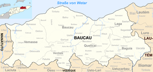
Before the 2015 territorial reform, Alawa Leten had an area of 7.65 km². Now it is 6.04 km². The Suco is located in the west of the Baguia administrative office. To the south and west is the Suco Alawa Craik , north of the Suco Samalari and east of the Suco Defawasi . The Danahine , a tributary of the Irebere , crosses the Suco.
The highways to Baucau and Loi Ulo roughly form the border to Alawa Craik. Another country road leads to Hae Coni in the west. Baguia , the main town of the administrative office , extends over the southwest border into the neighboring Suco . The site has a primary school, two pre-secondary schools, a community health center, and a helipad. It consists of several individual districts. On the side of Alawa Leten, these are Alaua 1 , Alaua 2 , Maurubi-assa East and West ( Maurubiassa ). In the northwest is the village of Ae-Afa ( Aiafa ) and in the southeast the villages of Alaua and Afaguia ( Afguia ).
In the Suco there are the five Aldeias Ae-Afa , Alaua , Bibilalari , Maurubi-Assa and Selibere .
politics
In the elections of 2004/2005 was Aleixo Atanasio Simões elected Chefe de Suco and in 2009 re-elected. In the 2016 elections , Zeferino Joaquim Ximenes won.
Personalities
- David Ximenes (* 1953), politician
Web links
- Results of the 2010 census for the Suco Alawa Leten ( tetum ; PDF; 8.6 MB)
- Results of the 2015 census for the Suco Alawa Leten (tetum; PDF)
- Seeds of Life: Suco information sheets Baguia (tetum)
Individual evidence
- ↑ a b c d Direcção-Geral de Estatística : Results of the 2015 census , accessed on November 23, 2016.
- ↑ a b UNMIT: Timor-Leste District Atlas version 02, August 2008 ( Memento from December 3, 2011 in the Internet Archive ) (PDF; 499 kB)
- ↑ Fallingrain.com: Directory of Cities, Towns, and Regions in East Timor
- ↑ Results of the 2010 census for the Suco Alawa Leten ( tetum ; PDF; 8.6 MB)
- ↑ Direcção Nacional de Estatística: Population Distribution by Administrative Areas Volume 2 English ( Memento from January 5, 2017 in the Internet Archive ) (Census 2010; PDF; 22.6 MB)
- ↑ a b http://websig.civil.ist.utl.pt/timorgis/Maps@[email protected] ( Memento from June 30, 2007 in the Internet Archive ) Timor-Leste GIS portal.
- ↑ Jornal da Républica with the Diploma Ministerial n ° 199/09 ( Memento of February 3, 2010 in the Internet Archive ) (Portuguese; PDF; 323 kB).
- ↑ Secretariado Técnico de Administração Eleitoral STAE: Eleições para Liderança Comunitária 2004/2005 - Resultados ( Memento of August 4, 2010 in the Internet Archive )
- ↑ Secretariado Técnico de Administração Eleitoral STAE: Eleições para Liderança Comunitária 2009 - Resultados ( Memento of August 4, 2010 in the Internet Archive )
- ↑ Jornal da República: Lista Naran Xefe Suku Eleito 2016 , December 2, 2016 , accessed on June 17, 2020.
