Albany (Illinois)
| Albany | ||
|---|---|---|
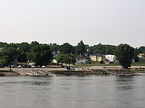
 Albany, Illinois from the Mississippi. 2018 |
||
| Location in Illinois | ||
|
|
||
| Basic data | ||
| Foundation : | 1837 | |
| State : | United States | |
| State : | Illinois | |
| County : | Whiteside County | |
| Coordinates : | 41 ° 47 ′ N , 90 ° 13 ′ W | |
| Time zone : | Central ( UTC − 6 / −5 ) | |
| Residents : | 891 (as of 2010) | |
| Population density : | 342.7 inhabitants per km 2 | |
| Area : | 2.6 km 2 (approx. 1 mi 2 ) of which 2.6 km 2 (approx. 1 mi 2 ) are land |
|
| Height : | 188 m | |
| Postcodes : | 61230 | |
| Area code : | +1 309 | |
| FIPS : | 17-00516 | |
| GNIS ID : | 403376 | |
Albany is a village in Whiteside County in the northwest of the US -amerikanischen State of Illinois on the east bank of the Mississippi . In 2010 Albany had 891 residents.
geography
Albany lies at 41 ° 47'18 "north latitude and 90 ° 13'09" west longitude. The city extends over 2.6 km², which consists exclusively of land.
Albany is on the east bank of the Mississippi River, which forms the border with Iowa . The Illinois State Route 84 runs through Albany along the Mississippi River and meets some minor roads in Albany.
The closest towns are Fulton, Illinois, 12 km north and Clinton, Iowa, across the river .
The Quad Cities are 42 km to the southwest, Peoria is 164 km to the southeast, Chicago is 237 km away and Madison , the capital of the neighboring state of Wisconsin , is 210 km to the northeast.
Demographic data
According to the 2010 census , Albany had 891 people in 383 households. The population density was 342.7 people per square kilometer. Statistically, 2.33 people lived in each of the 383 households.
The racial the population was composed of 98.3 percent white, 0.1 percent (one person) African American, 0.2 percent (two people) Native American, 0.3 percent (three people) Asian and 0.6 percent other ethnic groups; 0.4 percent were descended from two or more races. Regardless of ethnicity, 2.2 percent of the population was Hispanic or Latino of any race.
21.0 percent of the population were under 18 years old, 61.0 percent were between 18 and 64 and 18.0 percent were 65 years or older. 50.4 percent of the population was female.
The average annual income for a household was 61,146 USD . The per capita income was $ 28,540. 5.5 percent of the population lived below the poverty line.
Individual evidence
- ↑ US Postal Service - ZIP Codes
- ↑ a b American Fact Finder. Retrieved June 18, 2012
- ↑ Distance information according to Google Maps. Accessed on June 18, 2012
