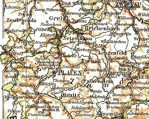
Administrative Authority Plauen
| Basic data | |
|---|---|
| District Headquarters | Zwickau |
| Administrative headquarters | Plauen |
| surface | 476 km² (1939) |
| population | 66,386 (1939) |
| Population density | 139 inhabitants / km² (1939) |
| Location of the Plauen administration in 1895 | |
The Amtshauptmannschaft Plauen was an administrative district in the Kingdom of Saxony and later in the Free State of Saxony . Most of its area today belongs to the Vogtlandkreis in Saxony. From 1939 to 1952 the administrative district was called Landkreis Plauen .
history
As part of the administrative reorganization of the Kingdom of Saxony, the four district offices of Dresden , Bautzen , Zwickau and Leipzig were set up in 1835. The Zwickau district administration had been subdivided into four administrative authorities since 1838 , including the fourth administrative authority , which emerged from the Voigtland district .
1,874 were in Saxony Kingdom as part of a comprehensive administrative reform new district governor teams set up and Amtshauptmann teams. The district administration of Plauen was formed from the court districts of Elsterberg, Pausa, Plauen and Reichenbach. In terms of their function and size, the Saxon authorities were comparable to a district .
In 1907 the city of Plauen became a district-free city and resigned from the administration. On July 1, 1920, the district administration lost its eastern part (around Neumark ) to the newly formed district administration Werdau and in 1924 the city of Reichenbach became district-free.
In 1939 the Plauen administrative authority was renamed the Plauen district . In 1946 Reichenbach was reintegrated into the district, which continued to exist in the GDR until the territorial reform of 1952 and was then divided into the new districts of Plauen-Land and Reichenbach in the Karl-Marx-Stadt district.
Office governors and district administrators
- 1874–1876: Otto Theodor Meusel
- 1877–1880: Johann Theodor Schmiedel
- 1880–1892: Johann Georg Freiherr von Welck
- 1892–1900: Adolf Maximilian von Polenz
- 1901–1905: Rudolf von Oppen
- 1905–1909: Hermann Walter Junck
- 1909–1919: Wilhelm Maximilian Mehnert
- 1919–1944: Alfred Beschorner
- 1944–1945: Bernhard Müller (acting)
Population development
| year | 1849 | 1871 | 1900 | 1910 | 1925 | 1939 |
|---|---|---|---|---|---|---|
| Residents | 154,582 | 202.881 | 170.215 | 100,405 | 65,252 | 66,386 |
Communities
Municipalities of the administrative authority of Plauen with more than 2,000 inhabitants (as of 1939):
| local community | Residents |
|---|---|
| Elsterberg | 5,242 |
| Mylau | 6,986 |
| Netzschkau | 7,376 |
| Break | 4.221 |
District-free cities in the area of the administrative authority of Plauen (status 1939):
| local community | Residents |
|---|---|
| Plauen | 109,556 |
| Reichenbach | 31,681 |
literature
- Thomas Klein : Outline of German administrative history 1815–1945. Row B: Central Germany. Tape. 14: Saxony. Johann Gottfried Herder Institute, Marburg / Lahn 1982, ISBN 3-87969-129-0 , pp. 403-405.
Web links
Individual evidence
- ^ A b Andreas Oettel: On the administrative structure of Saxony in the 19th and 20th centuries . In: State Statistical Office of the Free State of Saxony (Ed.): Statistics in Saxony . 175 years of official statistics in Saxony (Festschrift). No. 1 , 2006, ISSN 0949-4480 , p. 69-98 .
- ^ A b c Michael Rademacher: German administrative history from the unification of the empire in 1871 to the reunification in 1990. plauen.html. (Online material for the dissertation, Osnabrück 2006).


