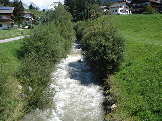
Antholz Bach
|
Antholz Bach Rio Anterselva |
||
| Data | ||
| location | Lawn-Antholz municipality , South Tyrol , Italy | |
| River system | Etsch | |
| Drain over | Rienz → Eisack → Etsch → Adria | |
| River basin district | Alpi Orientali | |
| origin |
Lake Anterselva 46 ° 53 ′ 3 ″ N , 12 ° 9 ′ 35 ″ E |
|
| Source height | 1642 m slm | |
| muzzle | at Neunhaeuser in the Rienz coordinates: 46 ° 46 ′ 21 ″ N , 12 ° 1 ′ 40 ″ E 46 ° 46 ′ 21 ″ N , 12 ° 1 ′ 40 ″ E |
|
| Mouth height | 980 m slm | |
| Height difference | 662 m | |
| Bottom slope | 34 ‰ | |
| length | 19.3 km | |
| Catchment area | 112 km² | |
The Antholzer Bach ( Rio Anterselva in Italian ) is a 19.3 kilometer long right tributary of the Rienza in South Tyrol .
geography
The Antholz Bach rises in Lake Anterselva at an altitude of 1642 m at the head of the Antholz Valley . In its upper reaches it is partially protected in the Rieserferner-Ahrn Nature Park . It drains an area of around 112 km² and is fed by numerous tributaries that flow to it from the Rieserferner group and the Villgraten mountains . In its course it flows through the settlements and localities of Antholz Obertal , Antholz Mittertal , Antholz Niedertal , Oberrasen and Niederrasen , all of which belong to the municipality of Rasen-Antholz . After Niederrasen, the Antholzer Bach reaches the Pustertal , where it flows into the Rienza at Neunhäusern at an altitude of 980 m .
Surname
The Antholzer Bach is attested as early as the 15th century as “the pach that runs through deforestation” or simply “the water” and in 1768 as “Antholzerpach”.
Web links
Individual evidence
- ↑ a b Geobrowser of the Autonomous Province of Bolzano - South Tyrol
- ↑ Antholzer Bach on the website of the South Tyrolean Environment Agency
- ^ Egon Kühebacher : The place names of South Tyrol and their history . 2: The historically grown names of the valleys, rivers, streams and lakes. Publishing house Athesia, Bozen 1995, ISBN 88-7014-827-0 , p. 26-27 .
