Aragvi
| Aragvi | ||
|
Aragvi near Mtskheta |
||
| Data | ||
| location | Mtskheta-Mtianeti ( Georgia ) | |
| River system | Kura | |
| Drain over | Kura → Caspian Sea | |
| Confluence of | Black and White Aragwi at Passanauri 42 ° 20 ′ 41 ″ N , 44 ° 41 ′ 42 ″ E |
|
| Source height | 1044.8 m | |
| muzzle | in the Kura near Mtskheta Coordinates: 41 ° 50 ′ 24 " N , 44 ° 43 ′ 34" E 41 ° 50 ′ 24 " N , 44 ° 43 ′ 34" E |
|
| Mouth height | approx. 445 m | |
| Height difference | approx. 599.8 m | |
| Bottom slope | approx. 9.1 ‰ | |
| length | 66 km | |
| Catchment area | 2740 km² | |
| Outflow at the Shinvali gauge |
MQ |
43.4 m³ / s |
| Left tributaries | Pshawi-Aragvi | |
| Reservoirs flowed through | Shinvali Dam | |
| Small towns | Shinvali , Mtskheta | |
| Navigable | not navigable | |
|
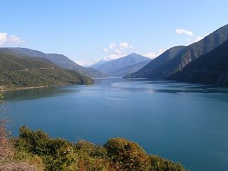
Shinwali reservoir on the Aragvi |
||
|
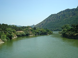
Lower reaches of the Aragwi not far from the confluence with the European route 60 |
||
|
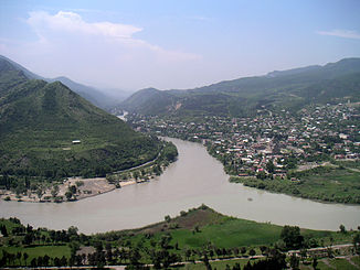
Mouth of the Aragwi (right) into the Kura |
||
|
White Aragwi Mtiuleti-Aragwi, Tetri Aragwi |
||
|
White Aragwi Gorge near Gudauri |
||
| Data | ||
| source |
Mtiuleti crest 42 ° 33 ′ 4 " N , 44 ° 22 ′ 46" E |
|
| Source height | approx. 3000 m | |
| Association with | Black Aragwi 42 ° 20 ′ 41 ″ N , 44 ° 41 ′ 42 ″ E
|
|
| length | 41 km | |
| Catchment area | 339 km² | |
| Drain |
MQ |
12.2 m³ / s |
| Communities | Gudauri , Kwemo Mleta , Passanauri | |
|
White Aragwi at Kwemo Mleta |
||
|
Black Aragwi Gudamaqari-Aragwi, Schawi Aragwi |
||
| Confluence of |
Bosseli and Bakurchewi 42 ° 24 '55 " N , 44 ° 45' 23" O |
|
| Association with | White Aragvi 42 ° 20 ′ 41 ″ N , 44 ° 41 ′ 42 ″ E
|
|
| length | 30 km | |
| Catchment area | 240 km² | |
| Drain |
MQ |
7.96 m³ / s |
The Aragwi ( Georgian არაგვი ) is a 66 kilometers (with the longer source river 112 kilometers) long left tributary of the Kura in northeast Georgia .
course
The actual Aragwi arises near the village and holiday resort Passanauri , about 70 kilometers as the crow flies north of the capital Tbilisi , from the white or Mtiuleti-Aragwi (Georgian თეთრი არაგვი , Tetri Aragwi or მთიულეთის არაგვი , Mtiuletis Aragwi ) and the black or Gudamaqari-Aragwi ( შავი არაგვი , Schawi Aragwi or გუდამაყრის არაგვი , Gudamaqris Aragwi ) from the left.
The White Aragwi as the longer of the source rivers bears its other name after the over 3800 m high Mtiuleti ridge, as the watershed ridge of the Greater Caucasus is called on this section. It rises at an altitude of more than 3000 m from the snow fields on the southern flank of the central section of this ridge, about seven kilometers northwest of the Cross Pass , and from there in a south-easterly direction through a partially narrow gorge in a south-easterly direction, past the several hundred meters above the river Gudauri resort . The Black Aragwi is also named after the Gudamaqari tributary which runs eastwards in a north-south direction. In turn, it arises from the source rivers Bosseli and Bakurchewi , which arise closer to the eastern end of the Mtiuleti ridge.
From Passanauri the Aragwi flows mainly due south until it flows into the Kura (Georgian Mtkvari ) at Mtskheta , a few kilometers north of Tbilisi . The city of Mtskheta itself is on the right (above) the mouth; to the left stands the famous Jvari Monastery high on a ridge .
In almost half of its course between Passanauri and Mzcheta, the Aragwi is dammed up above the small town of Shinwali and immediately below the confluence of its most important tributary, the Pschawi-Aragwi ( ფშავის არაგვი , Pschawis Aragwi ), coming from the left , to the Shinwali reservoir. The Pschawi-Aragwi flows in its middle course from the right of the Chewsureti-Aragwi ( ხევსურეთის არაგვი , Chewsuretis Aragwi ). These two rivers are named after the historical names of the mountain provinces in the northeast of today's Mzcheta-Mtianeti , Pschawi and Chewsureti (German also Chewsuretia ).
Hydrology
The catchment area of the river covers 2740 km². The mean annual discharge on the middle reaches, at the Shinwali gauge below the reservoir of the same name, is 43.4 m³ / s.
Use and infrastructure
The Aragwi is not navigable.
The Shinvali reservoir, completed in 1986, with its 102 meter high dam is one of the largest in Georgia. The hydropower plant located there has an output of 130 megawatts . In addition, a 36.7-kilometer pipeline begins there to supply the capital Tbilisi with drinking water . On the lower reaches, the water of the Aragwi is also used to irrigate agricultural areas.
The Aragwi is followed from its mouth by the European route 60 (corresponding to the Georgian trunk road S1 ), which has been developed there as a motorway , for several kilometers and then crossed. There the European route 117 branches off (Georgian S3 ), which runs along the Aragwi for its entire length on the right side of the valley. The road follows the old Georgian Army Road and is also named. Above Passanuri, the road in the valley of the White Aragvi changes to the left side of the valley before it leaves the river over the Cross Pass into the valley of the Terek and on to Vladikavkaz in Russia .
Web links
Individual evidence
- ↑ Soviet General Staff Map 1: 50,000. Sheet K-38-54-W
- ↑ Soviet General Staff Map 1: 50,000. Sheet M-38-78-A
- ↑ a b c Article Aragwi in the Great Soviet Encyclopedia (BSE) , 3rd edition 1969–1978 (Russian)
- ↑ a b c Slovar ʹ sovremennych geografičeskich nazvanij . U-Faktorija, Yekaterinburg 2006 (Russian, article Арагви in the Great Soviet Encyclopedia (BSE) , 3rd edition 1969–1978 (Russian) ).


