Aschbach (Tauber)
|
Aschbach Aspach |
||
|
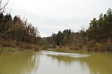
The Aschbach in the Adolzhäuser Valley, south of Herrenzimmern, 2018 |
||
| Data | ||
| Water code | DE : 24652 | |
| location |
Kocher-Jagst Plains
|
|
| River system | Rhine | |
| Drain over | Tauber → Main → Rhine → North Sea | |
| source | in the forest between Mulfingen - Hollenbach and Niederstetten- Adolzhausen on the B 290 49 ° 23 ′ 6 ″ N , 9 ° 50 ′ 49 ″ E |
|
| Source height | approx. 425 m above sea level NHN | |
| muzzle | between Elpersheim (near Weikersheim) and Markelsheim (near Bad Mergentheim) on the city limits ( Weikersheim - Bad Mergentheim ) from the left and south into the middle Tauber coordinates: 49 ° 28 ′ 20 ″ N , 9 ° 51 ′ 9 ″ E 49 ° 28 20 ′ N , 9 ° 51 ′ 9 ″ E |
|
| Mouth height | 212.7 m above sea level NHN | |
| Height difference | approx. 212.3 m | |
| Bottom slope | approx. 16 ‰ | |
| length | 13 km | |
| Catchment area | 26.873 km² | |
| Discharge at the Herrenzimmern A Eo gauge : 13.87 km² Location: 6.549 km above the estuary |
MNQ MQ Mq MHQ HHQ |
22 l / s 126 l / s 9.1 l / (s km²) 3.96 m³ / s 29 m³ / s |
| Small towns |
only EZG -randschipsel: Weikersheim |
|
| Communities |
only EZG edge snippets: Mulfingen |
|
The Aschbach is a 13 km long brook in the Main-Tauber district in northern Baden-Württemberg , which, after a somewhat eastward sweeping run, turns northwards at the city limits between the village of Elpersheim von Weikersheim and the village of Markelsheim von Bad Mergentheim from the left flows into the middle Tauber .
geography
course
The Aschbach rises over 2.5 km southwest of the center of the Adolzhausen district of the small town of Niederstetten in the district of the village. The top spring is in the forest in the Gettersklinge at about 425 m above sea level. NHN , less than a hundred meters from the portion of the well Kaiserstrasse said B 290 between Riedbachstraße and Herbsthausen , between the outlets of both leading in the direction Adolzhausen K 2854 and K 2853. The stream flows at first with slow small directional changes in north-western to mainly north northeast directions .
First his path leads past a clearing in the Gettersklinge forest. It flows through the permanent lake of a first flood retention basin, then leaves the forest under the K 2853 and then passes through the damming of a second retention basin right at the deserted area of Dunkenrot . After he was about 384.8 m above sea level. NHN has taken its first major tributary Hainbach from the west, the creek basin develops into a valley with partly long wooded areas on both slopes. The connecting road from the more distant Adolzhausen in the southeast to Schönbühl in the northwest crosses the valley on the dam of the third retention basin on the run, which is usually not dammed. After the Aschbach has passed the town of Schönbühl on the left slope, the Adolzhäuser Bach flows in from the south-southeast, which has passed the eponymous town on its middle course.
A little later, the Aschbach flows into the Herrenzimmern flood retention basin, which has the largest area of all lakes in the catchment area. The brook from the Branzenklinge, which previously touched Adolzhausen on the opposite side of the Adolzhäuser Bach, flow into it shortly after each other, and the Greifenbrunnenbach from the east via a long mouth of the lake. After that, the now deeply deepened Kerbtal in the shell limestone runs almost to the mouth in a north-north-westerly direction, the brook oscillates in it quite naturally in small loops between the two feet of the slope.
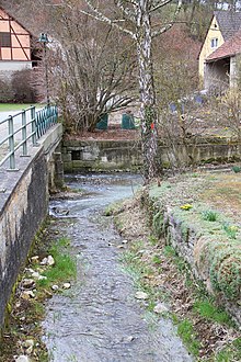
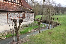
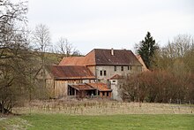
The stream only reaches the place Herrenzimmern after a distance between forest slopes of a good one kilometer after the dam of the retention basin named after him. The village is the first and largest valley town and lies at the inlet of a side valley from the east, from which the Pfitzinger Bach reinforces the Aschbach, the last of its larger tributaries. A little after the village follows the Untere Mühle on the right bank and after a little over a kilometer the stream flows through the smaller valley village of Rüsselhausen , which also belongs to Niederstetten.
The stream now changes, initially again between forest slopes, for its last 3 kilometers over into the Markelsheim district of the neighboring town of Bad Mergentheim and after half of this distance passes the Markelsheim settlement site Schneidmühle on the left bank. The heights to the left and right of the valley that are open from there fall sharply towards the Taubertal and the stream crosses under the road from Elpersheim to Markelsheim.
The Aschbach finally flows into 212.7 m above sea level. NHN between Weikersheim - Elpersheim and Bad Mergentheim-Markelsheim on the city limits from the left and south into the middle Tauber , about 212 meters below its source and after a 13 km long path with an average bed gradient of about 16 ‰.
Catchment area
The Aschbach has a 26.9 km² catchment area, which extends from Mönchswald a little north of the Mulfingen hamlet of Staigerbach about 10 km north to the mouth and is a maximum of 4 km wide across it. The highest point on the southeast corner in Stockholz near Niederstettener hamlet Ermershausen reaches about 455 m above sea level. NHN . Because the larger tributaries come in from the right, the catchment area in the upper part is strongly right-leaning. Almost a third is covered by forest, which occurs mainly in larger islands. The open land in between is mostly under the plow on the plateau, while on the valley floor there are mostly meadows and numerous stone bars run down the slope on the slopes of the Aschbach and its larger side valleys .
From a natural point of view, the southern part belongs to the sub-area Bartenstein-Langenburger Platten of the Kocher-Jagst plains , the rest is distributed almost entirely over the sub-areas of the Tauberland Umpfer-Wachbach-Riedel in the west to the right valley slope and southern Tauberplatten in the eastern connection. Only a small mouth gusset is part of its sub-area Middle Taubertal in the far north.
In turn, the catchment areas of the following neighboring waters are adjacent:
- On the northeast side from the mouth up to near Pfitzingen, the noticeably smaller Dürrbach , which flows into the Tauber shortly before the Aschbach, competes on the other side ;
- on the other side of the eastern watershed, the larger Vorbach also flows northwards to the Tauber, to which the Schöntalbach on the southeast side of the Frickentalbach flows to the other side;
- the southern section of the total watershed is its topographically and hydrologically most important section, as it reaches its greatest heights here and here the large catchment area of the Main Tauber tributary on this side meets that of the Neckar tributary Jagst on the other side; the immediate competitors are the Jagst tributaries Ette in the eastern and Rissbach in the western section;
- at the southwest corner, the catchment area boundary separates only a short section from the drainage area of the Wachbach , which flows into the Tauber again;
- along the long west side is the drainage area of the little smaller next left Tauber tributary Lochbach .
Over three quarters of the catchment area are in the urban area of Niederstetten , they are spread over the district markings of Adolzhausen in the south, Herrenzimmern in the middle west, Pfitzingen in the middle east and Rüsselhausen in the middle north. The already narrow mouth wedge in the far north is largely part of the Markelsheim district marking of Bad Mergentheim , a narrow marginal strip in the southwest of its district marking Herbsthausen and Rot ( Schönbühler district exclave). Even smaller marginal gussets belong to the southwest corner of the municipality of Mulfingen in Hohenlohekreis and on the northeast edge and the eastern edge near the mouth of the river to two district markings of Weikersheim .
Tributaries and lakes
Hierarchical list of tributaries and ![]() lakes from source to mouth. Length of water, lake area, catchment area and altitude according to the corresponding layers on the LUBW online map. Other sources for the information are noted.
lakes from source to mouth. Length of water, lake area, catchment area and altitude according to the corresponding layers on the LUBW online map. Other sources for the information are noted.
Source of the Aschbach at about 425 m above sea level. NHN in the forest around the upper Gettersklinge north next to the B 290 between the district roads K 2854 and K 2853 going in the direction of Niederstetten - Adolzhausen. The stream flows in moderate and long arcs consistently northwards.
-
 Flows through the forest in front of the K 2853 at about 408 m above sea level. NHN a flood retention basin with permanent storage and fore basin, a total of 0.4 ha.
 -
 Flows through in the corridor shortly after the K 2853 to about 397 m above sea level. NHN the Lower Lake , a flood retention basin with permanent storage, 0.5 ha.
 -
Hainbach , from the left and southwest to about 384.8 m above sea level. NHN , 0.9 km and approx. 0.9 km². Arises at about 414 m above sea level. NHN on the B 290. It is mainly a dirt road ditch in a natural hollow between Gewannen Morgen and Birkenbusch .
- (Inflow), from the left and west-southwest to about 395 m above sea level. NHN at the influence in the Upper Lake , approx. 0.5 km and approx. 0.2 km². Arises at about 412 m above sea level. NHN on the B 290. Is a long field path ditch in a natural hollow between the Birkenbusch and Süßer Weg channels .
-
 Flows through at about 395 m above sea level. NHN the dammed Upper Lake on the city limits of Bad Mergentheim to Niederstetten, 0.6 ha.
 - (Inflow), from the left and west to about 395 m above sea level. NHN in the Upper Lake , approx. 0.7 km and approx. 0.3 km². Arises at about 415 m above sea level. NHN on the B 290. At the beginning, it is a dirt road ditch in a natural hollow between the Susser Weg and Saurer Weg channels .
-
 Passed at about 383 m above sea level. NHN a pond on the right bank, just under 0.1 ha.
 - Lindlebach , from the right and east-southeast to 361.4 m above sea level. NHN in the Lindle forest west of Niederstetten- Adolzhausen , 0.4 km and over 0.1 km². Arises at about 397 m above sea level. NHN near the eastern edge of the forest.
- Flows through at about 355 m above sea level. NHN a flood retention basin without permanent impoundment, over whose dam the Adolzhausen – Schönbühl road runs.
- Adolzhäuser Bach , from the right and south-southeast to 325.9 m above sea level. NHN northwest of Adolzhausen, 2.4 km and 3.1 km². Arises at about 396 m above sea level. NHN south of Adolzhausen from two drainage ditches that are less than half a kilometer long and converge behind a road dam.
-
 Flows through at 315 m above sea level. NHN the Herrenzimmern flood retention basin with permanent storage, 1.3 ha, also called Aschbachsee .
 - (Bach from the Branzenklinge ), from the right and south-southeast to 315 m above sea level. NHN in Herrenzimmern flood retention basin, 2.2 km and approx. 1.3 km². Starts at about 415 m above sea level. NHN as a field path ditch at a fork in the field in front of the Eichholz a little southeast of Adolzhausen.
-
Greifenbrunnenbach , from the right and southeast to 315 m above sea level. NHN in the flood retention basin over a long eastern side bay, 2.8 km and 2.6 km². First runs as a ditch accompanying the path in a natural hollow northwards, then westwards through a deepening notch valley.
-
 Arises in the drainage area of a pond on Schöntaler Hölzle at about 430 m above sea level. Below 0.2 ha.
-
- Dry valley Webersklinge , from the left and south-east to around 335 m above sea level. NHN about 0.3 km before the influence in the retention basin.
- → (exit of the Mühlkanal to Herrenzimmern), to the right to about 305 m above sea level. NHN after a short section with forest on the slopes.
- ← (return of the Mühlkanal to Herrenzimmern), from the right to below 290 m above sea level. NHN in Herrenzimmern , 0.7 km.
-
Pfitzinger Bach , from the right and east to about 290 m above sea level. NHN in Herrenzimmern, 2.1 km and 4.4 km². Arises at about 361 m above sea level. NHN on the western edge of Pfitzingen .
- Schmähbach , from the left and southeast to about 352 m above sea level. NHN little to Pfitzingen, 0.7 km and about 0.8 km². Arises at about 373 m above sea level. NHN south of Pfitzingen in front of the Schindklinge in Heiligenholz .
- Baindgraben , from the right and northeast to about 335 m above sea level. NHN , 1.2 km and about 0.7 km². Arises at about 399 m above sea level. NHN north of Pfitzingen on the K 2843.
- → (exit of the Mühlkanal to Untere Mühle), to the right less than a hundred meters after the inflow of the Pfitzinger Bach in Herrenzimmern.
- (Stream from the slip ), from the left and west-southwest to about 278 m above sea level. NHN about a hundred meters in front of the lower mill opposite, about 0.7 km and about 0.9 km². Arises at about 325 m above sea level. NHN at the edge of the forest in the hatch . Inconsistent.
- ← (return of the mill canal to the lower mill), from the right to about 275.8 m above sea level. NHN at the lower mill .
- (Stream along the Höllweg ), from the right and east-northeast to about 266.2 m above sea level. NHN less than half a kilometer from Rüsselshausen , approx. 0.8 km and approx. 0.9 km². Arises at about 348 m above sea level. NHN . Inconsistent Klingenbach.
-
 Passes a group of ponds within a right creek loop at about 221 m above sea level. NHN on the Elpersheim – Markelsheim road, a total of 0.3 ha.
Mouth of the Aschbach from the left and south to 212.7 m above sea level. NHN between Weikersheim - Elpersheim and Bad Mergentheim - Markelsheim in the middle Tauber . The Aschbach is 13 km long and has a 26.9 km² catchment area.
Flood retention basin
| Surname | location | Tributaries | Storage space in m 3 | EZG | Storage space | Dam height | Construction year | ||||
|---|---|---|---|---|---|---|---|---|---|---|---|
| place | Maximum | Duration | Max | Duration | |||||||
| (HRB in the Gettersklinge ) | ⊙ | southwest | Adolzhausen | Aschbach | ? | ? | 0.4 km 2 | ? | 0.3 ha | ? | ? |
| (HRB at Wüstung Dunkenrod ) | ⊙ | southwest | Adolzhausen | Aschbach | ? | ? | 0.7 km 2 | ? | 0.5 ha | ? | ? |
| HRB Adolzhausen-Schönbühl | ⊙ | west southeast |
Adolzhausen Schönbühl |
Aschbach | 191,000 | - | 4.5 km 2 | ? | - | 15.24 m | 1973 |
| HRB men's rooms | ⊙ | south - south- east northeast north - northwest |
Gentlemen's rooms in Schönbühl Adolzhausen |
Aschbach, Bach from the Branzenklinge , Greifenbrunnenbach | 95,000 | 20,000 | 12.7 km 2 | ? | 1.3 ha | 12.15 m | 1958 |
| Information on storage space, dam height and year of construction according to the reservoir layer , on the usual area of the permanently dammed basins according to the standing water layer from the State Institute for the Environment Baden-Württemberg (LUBW) ( information ) (retention basins with entry "-" are usually waterless). The catchment areas were measured, with extensive adoption of the area values for the sub-catchment areas that were not to be cut up according to the same source. | |||||||||||
Places and settlement areas
The following places and desolations with their administrative affiliations lie on the course of the Aschbach; only the names of the lowest nesting level designate neighboring settlements:
- City of Niederstetten
- Adolzhausen district
- City of Bad Mergentheim
- City of Niederstetten
- District gentlemen
- Gentlemen's rooms (village)
- Lower mill (homestead, right)
- Rüsselhausen district
- Rüsselhausen (village)
- District gentlemen
- City of Bad Mergentheim
- Markelsheim district
- Cutting mill (settlement area, left)
- Markelsheim district
The villages that make up a district are also located in the catchment area
- Adolzhausen on the ridge between the middle Adolzhäuser Bach and the brook from the Branzenklinge and
- Pfitzingen at the beginning of the Pfitzinger Bach
as well as the local desert
- Schöntal on the Adolzhausen district at the source pond of the Greifenbrunnenbach.
geology
The landscape is shaped by the shell limestone underground. In the southern part, which is therefore part of the Kocher-Jagst plains, there is still a layer of Lettenkeuper ( Erfurt Formation ), in which the stream also originates, and this in turn is sometimes islands of loess sediment from Quaternary deposits. The stream bed of the Aschbach soon lies in the Upper Muschelkalk , which also covers the larger part of the plateau, around Pfitzingen in turn covered by Lettenkeuper. A little before Herrenzimmern the valley floor reaches the Middle , a little after Rüsselhausen then the Lower Muschelkalk . From around the Markelsheimer Schneidmühle, the slopes slowly sloping down towards the Taubertal valley on both sides over the Aschbach-Mulde are covered first on the left and then on the right by loess-bearing floating earth .
Close to the southern edge, in the catchment area in the almost closed Lettenkeuper zone, there are some short, roughly west-east-moving fault lines, at least sometimes with the tectonic high block in the south. Pfitzingen and the Lettenkeuper zone surrounding it are located in the area of a tectonic rift that begins in the eastern part of the catchment area and continues in a north-northeast direction across its border, which often moves Lettenkeuper inside against Upper Muschelkalk outside.
At the northeast corner of the catchment area north of Pfitzingen are several long-abandoned quarries to the right of the L 2853 Pfitzingen – Weikersheim on the forest island Steinholz . The mining went on the main sandstone of the Lettenkeuper occurring here extensively and produced a massive, coarse to medium-grain sandstone with a lot of mica and recognizable inclined stratification .
Nature and protected areas
The valley of the Aschbach from about the Lindlebach tributary, the valley of the Adolzhäuser Bach below Adolzhausen as well as the lower part of the Branzenklinge and the valley of the Greifenbrunnenbach belong, with the exception of only the localities of Herrenzimmern and Rüsselhausen, a total of three landscape protection areas divided into the municipalities: the majority is in that of Niederstetten , the smaller one (with two segments, a small one on the upper reaches near Schönbühl, a large one on the lower reaches) in that of Bad Mergentheim , only a marginal gusset on the lower reaches of that of Weikersheim .
Portions of the western watershed on the upper reaches, the eastern watershed near Pfitzingen and the lower reaches are in water protection areas.
The creek is classified as fine material rich up to the forest exit at the uppermost course, then as coarse material rich carbonate low mountain range.
See also
Individual evidence
LUBW
Official online waterway map with a suitable section and the layers used here: Course and catchment area of the Aschbach
General introduction without default settings and layers: State Institute for the Environment Baden-Württemberg (LUBW) ( notes )
- ↑ a b c Height according to the contour line image on the background layer topographic map .
- ↑ a b c d e f g Height according to black lettering on the background layer of the topographic map .
- ↑ a b c Length according to the waterway network layer ( AWGN ) .
- ↑ a b catchment area after the layer aggregated areas 05 .
- ↑ Lake area after the layer standing waters .
- ↑ Catchment area measured on the background layer topographic map .
- ↑ a b c d Length measured on the background layer topographic map .
- ↑ a b c Catchment area according to the basic catchment area layer (AWGN) .
- ↑ Protected areas according to the relevant layers.
Other evidence
- ↑ Topographical Atlas of the Kingdom of Württemberg
- ↑ Flood forecast center , State Office for the Environment Baden-Württemberg (adopted on March 17, 2018)
- ↑ Wolf-Dieter Sick : Geographical land survey: The natural space units on sheet 162 Rothenburg o. D. Deaf. Federal Institute for Regional Studies, Bad Godesberg 1962. → Online map (PDF; 4.7 MB)
- ↑ Height according to the contour map on the WMS ATKIS digital topographic map on: Geoportal Baden-Württemberg ( information )
- ↑ Geology according to the layers for Geological Map 1: 50,000 on: Map server of the State Office for Geology, Raw Materials and Mining (LGRB) ( notes )
- ↑ Geotope Abandoned quarries on the Pfitzingen – Weikersheim road north of Pfitzingen according to its geotope profile .
literature
- Topographic map 1: 25,000 Baden-Württemberg, as single sheet No. 6525 Weikersheim and No. 6626 Schrozberg Ost
Web links
- Map of the course and catchment area of the Aschbach on: State Institute for the Environment Baden-Württemberg (LUBW) ( information )
- Map of the Aschbach headwaters on: Geoportal Baden-Württemberg ( information )
- Measuring table sheet 6626 Gammesfeld from 1944 in the Deutsche Fotothek (only upper catchment area)


