Havelland motorway triangle
| Havelland motorway triangle | |
|---|---|
|
|
|
| map | |
| location | |
| Country: | Germany |
| State : | Brandenburg |
| Coordinates: | 52 ° 42 '47 " N , 13 ° 0' 43" E |
| Height: | 33 m above sea level NN |
| Basic data | |
| Design type: | triangle |
| Bridges: | 3 (motorway) |
| Construction year: | 1979 |
| Last modification: | 2012-2014 |
| Aerial photo from AD Havelland in May 2014 | |
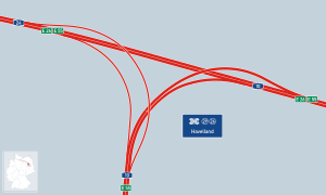
The Havelland motorway triangle (abbreviation: AD Havelland ; short form: Havelland triangle ) is a motorway triangle in Brandenburg in the Berlin metropolitan region . It connects the federal highway 24 ( Hamburg - Berlin ) to the federal highway 10 ( Berliner Ring ).
geography
The triangle is located in the eponymous region Havelland , in the area of the municipalities of Oberkrämer and Kremmen in the Oberhavel district . The surrounding communities are Schönwalde-Glien and Nauen . It is located about 30 km northwest of downtown Berlin, about 35 km north of Potsdam and about 220 km southeast of Hamburg.
The Havelland motorway triangle has junction number 26 on the A 24 and number 29 on the A 10.
history
The Havelland motorway triangle was created in the course of an expansion of the Berliner Ring between 1972 and 1979. Until 1990 it was called the Rostock branch .
In July 2011, the planning approval decision for the six-lane expansion from the Neuruppin junction (A 24) to the Oberkrämer junction (A 10) including the renovation of the Havelland triangle was published. The symbolic groundbreaking ceremony for the extension of the Havelland – Kremmen triangle section took place on September 17, 2012 . At the time, costs of 52 million euros were expected.
The converted motorway triangle was officially opened to traffic on November 18, 2014. The investment costs for the conversion of the motorway junction and the Kremmen junction came to 60 million euros; in March 2012, only 45.5 million euros were estimated. The European Union contributed 18 million euros from the European Regional Development Fund to the financing.
Design and state of development
The main route leads in a straight line from west to east into the Berliner Ring and connects the A 24 coming from the west with the A 10 running from south to east.
During the renovation, the curve radii, some of which were too small, were replaced by direct connecting ramps, lane cross-sections were enlarged and hard shoulder was added. The triangle now consists of three bridge structures. For the connection from the northern Berliner Ring to the A 24 there are three lanes in each direction, between the western Berliner Ring and the A 24 there are still two lanes in each direction. So-called whispered asphalt was used as the road surface . In addition, an almost 800 meter long noise barrier was built on the south side of the A 10.
Before the renovation, both motorways had four lanes. All connecting ramps were designed with two lanes. The triangle was originally designed as a left-handed trumpet .
Traffic volume
A traffic census in 2015 showed the following pollution on the motorway triangle:
| From | To | Average daily traffic volume |
Share of heavy goods traffic |
|---|---|---|---|
| AS Falkensee (A 10) | AD Havelland | 34,700 | 15.7% |
| AD Havelland | AS Oberkrämer (A 10) | 55,300 | 14.2% |
| AS Kremmen (A 24) | AD Havelland | 52,300 | 12.3% |
For the year 2025, 65,000 vehicles per day and direction are forecast.
Web links
- Background information on the expansion: State Office for Roads in Brandenburg
- Construction site documentation Photos and videos: aerial photo documentation updated continuously
Individual evidence
- ^ AD Havelland. Motorway junctions and triangles in Germany, 2011, accessed on February 1, 2013 .
- ↑ a b c d The way north is free . In: Berliner Morgenpost . November 17, 2014, p. 15 ( online [accessed December 9, 2014]).
- ↑ Planning approval decision for the 6-lane expansion of the federal motorway (BAB) 24 and the BAB 10. (No longer available online.) State of Brandenburg, Ministry of Infrastructure and Agriculture, July 26, 2011, archived from the original on May 13, 2012 ; Retrieved April 6, 2012 . Info: The archive link was inserted automatically and has not yet been checked. Please check the original and archive link according to the instructions and then remove this notice.
- ↑ Groundbreaking ceremony for the efficient Havelland motorway triangle. Federal Ministry of Transport, Building and Urban Development, September 17, 2012, archived from the original on September 23, 2012 ; Retrieved October 2, 2012 .
- ↑ Further EU funds secured for the expansion of the A 10. Federal Ministry of Transport, Building and Urban Development , May 29, 2012, accessed on April 1, 2018 .
- ↑ Manual traffic census BAB 2015. (PDF) BASt Statistics, 2015, accessed on September 1, 2017 .

