
Autoroute 3 (Luxembourg)
| Autoroute A3 in Luxembourg | ||||||||||||||||||||||||||||
_number.png)
|
||||||||||||||||||||||||||||
| |
||||||||||||||||||||||||||||
| map | ||||||||||||||||||||||||||||
 |
||||||||||||||||||||||||||||
| Basic data | ||||||||||||||||||||||||||||
| Operator: | Administration des Ponts et Chausses | |||||||||||||||||||||||||||
| Overall length: | 13.318 km | |||||||||||||||||||||||||||
|
Cantons : |
||||||||||||||||||||||||||||
|
Course of the road
|
||||||||||||||||||||||||||||
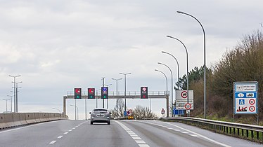
The car Route 3 , just A3 , also under Diddelenger Autobunn known is an important part of the motorway network in the Grand Duchy Luxembourg and runs in a north-south direction over a distance of 13.318 km of Gasperich / Howald to the Luxembourg-French border crossing Dudelange where they merges into the French A31 to Diedenhofen . Access to the A3 is provided by three exits and exits as well as two motorway junctions and a service area.
At Gasperich the B3 merges into the A3. At the Gaspericher Kreuz it crosses the A1 / A6 . The Aire de Berchem (rest stop) with Europe's largest petrol station follows.
A little further south, the A3 crosses the A13 (Collectrice du Sud / Liaision avec la Sarre) at Bettemburger Kreuz .
The motorway was put into operation between 1978 and 1981 and was designed as a replacement / relief for national road 3 . Since the A3 is often used by holidaymakers on their way to the Mediterranean coast, it is also often referred to as the "Autoroute du soleil".
gallery

The A3 in a southerly direction from the footbridge in Bettemburg seen from
The A3 shortly after crossing the border with France

