Bikaner
| Bikaner बीकानेर |
||
|---|---|---|
|
|
||
| State : |
|
|
| State : | Rajasthan | |
| District : | Bikaner | |
| Location : | 28 ° 1 ′ N , 73 ° 19 ′ E | |
| Height : | 225 m | |
| Area : | 155 km² | |
| Residents : | 644,406 (2011) | |
| Population density : | 4157 inhabitants / km² | |
| Website : | Bikaner | |
| Bikaner - Fort Junagarh (around 1590) | ||
Bikaner ( Hindi : बीकानेर , Bīkāner ) is a city (Municipal Corporation) with about 660,000 inhabitants in the north of the Indian state of Rajasthan .
location
Bikaner is located in the north of the Thar desert at an altitude of about 225 m above sea level. d. M. The city of Jaipur is about 335 km (driving distance) to the southeast; to Delhi it is approx. 450 km in an easterly direction.
climate
The climate of Bikaner is warm to hot and dry; the extremely low rainfall of less than 250 mm / year for Indian conditions mainly falls during the summer monsoon season .
The climate crisis has led to a drastic shortage of drinking water in large parts of India . This is particularly noticeable in Bikaner. The city is one of those 21 major Indian cities whose groundwater reserves will be completely depleted in 2020 according to calculations by the government agency NITI Aayog.
population
Official population statistics have only been kept and published since 1991. The strong increase in population is mainly due to the immigration of families from the villages in the surrounding area.
| year | 1991 | 2001 | 2011 |
| Residents | 416.289 | 529.690 | 644.406 |
The Hindi and Urdu- speaking population consists of almost 78.7% Hindus , approx. 17.3% Muslims and almost 3% Jains ; numerically small minorities are Christians , Sikhs , Buddhists and others. As is common in censuses in northern India, the male population is about 11% higher than the female.
economy
Bikaner was once an important trading post along the caravan route through the Thar desert. In the area around the village, fields and livestock were farmed on a small scale. Today the district is connected to the Indira-Gandhi Canal , which enables the irrigation of large agricultural areas in the west of the city. Otherwise, the Bikaner district exports wool, primarily to Jaipur , and quartz for glass production to Belgium; its own glass industry has not yet been established. In addition, tourism and the military stationed in the surrounding area are also important sources of income. Southeast of the city is the only state camel farm in Asia, whose animals are mainly used in parades today. Traders, craftsmen and service providers of all kinds have settled in the city itself.
history
Rao Bikaji, a later-born son of the ruler of Jodhpur from the clan of the Rathor- Rajputs , and therefore not entitled to inheritance , founded the town on the edge of the desert, which also became the capital of the princely state of Bikaner . At first it consisted only of a simple clay fortress. It was not until the end of the 16th century that Raja Rai Singh (r. 1571-1612), who was in the service of the Grand Mogul Akbar I and ruled over large areas of Marwar and Gujarat , and his successors built and expanded the city palace that still exists today , the Junagarh Fort . During the decline of the Mughal Empire, the area fell into the hands of the Marathas ; from 1818 it was a protectorate of the British , but retained large parts of its sovereignty. Shortly after Indian independence (1947), the formerly huge national territory (approx. 60,000 km²) was divided into several districts ( Bikaner , Churu , Sri Ganganagar and Hanumangarh ). In the western area around Bikaner, near the border with Pakistan, nearly 120,000 Indian armed forces are stationed.
Attractions
- The Junagarh Fort is built from bricks and clad with reddish-yellow sandstone , inside partly with white marble . Filigree, sometimes a bit kitsch-looking wood, lacquer and stucco work with mirror and glass inlays as well as wall paintings decorate the interior. The fort is now one of the best preserved Rajput palaces; however, it is largely used as a museum.
- The Lakshmi Nath Temple with his Shikhara -Turm was also founded according to tradition by Raja Bikaji; however, much of the current structure was changed or added later.
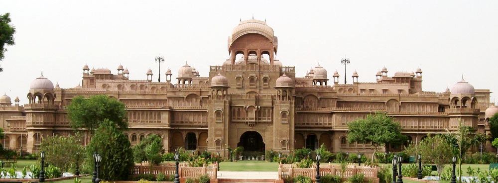
- The Lallgarh-Palace , built between 1902 and 1926 by Sir Swinton Jacob for the Maharajah Ganga Singh in the Indo-Oriental style, is now used as a hotel.
- The Laxmi-Niwas-Palace , with its roof pavilions ( chhatris ) and balconies ( jharokhas ) , was more architecturally oriented towards Rajput traditions and was built around the same time; it also serves as a hotel today.
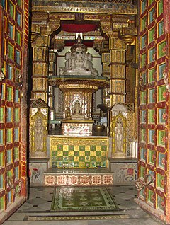
- The two-storey Bhandasar Jain temple, which was built around 1500 but has changed again and again, also has palatial features - despite its significantly smaller dimensions. Here, too, there are tiles, stucco work, paintings and gold leaf coatings; some of the wall templates covered with white marble are adorned with colored stone inlays.
- In Bikaner there are several imposing merchant palaces ( havelis ), whose facades here - unlike in the Shekhawati region - do not convince with paintings, but with fine stone processing. Above all, the complex of the Rampuria Havelis should be mentioned here.
- Surroundings
- Approx. 8 km east of a pond named Devi Kund are the cremation sites and thus also the cenotaphs (chhatris) of the Maharajas of Bikaner.
- Approx. The only camel farm in India is located 18 km southeast of the city. Camels are bred here and their milk can be drunk.
- Approx. The so-called "Rat Temple" ( Karni-Mata Temple ) is located 30 km south of Bikaner in the small town of Deshnok .
- Approx. 35 km southwest of Bikaner, on the banks of an artificially created lake, is the Gajner Palace, which has been converted into a hotel . The area covers about 6000 hectares and has become a small nature reserve.
literature
- Lothar Clermont, Thomas Dix: Rajasthan. Stürtz-Verlag, 2010, ISBN 978-3-8003-1966-4 .
Web links
- Bikaner, various - photos + information (English)
- Bikaner, various - photos + information
- Bikaner, camel farm - photos
- Bikaner, Gajner Palace - photos + information
Individual evidence
- ^ Bikaner - data 2011
- ↑ Bikaner - map with altitude information
- ↑ Bikaner - climate tables
- ↑ Jessie Yeung, Swati Gupta, Michael Guy: India has just five years to solve its water crisis, experts fear. Otherwise hundreds of millions of lives will be in danger. In: CNN. July 4, 2019, accessed on July 10, 2019 .
- ^ Bikaner - City Population 1991-2011
- ↑ Bikaner - Census 2011


