Biscayne Bay
| Biscayne Bay | ||
|---|---|---|
|
Biscayne National Park in the south of the bay |
||
| Waters | Atlantic Ocean | |
| Land mass | Florida (peninsula) | |
| Geographical location | 25 ° 34 ′ N , 80 ° 13 ′ W | |
|
|
||
| width | approx. 15 km | |
| length | approx. 80 km | |
| surface | 1 110 km² | |
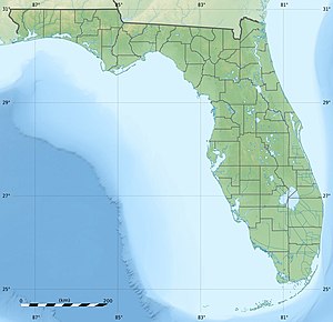
The Biscayne Bay is a bay of the Atlantic Ocean in the southeast of the US state of Florida . The bay has a total area of about 1110 km².
geography
Biscayne Bay is part of the Atlantic Intracoastal Waterway and extends about 80 km in length and 15 km in width along the coast in southeast Florida. In the north, the bay begins at North Miami . In the south, the bay extends to the end of North Key Largo , to the point where the Overseas Highway , coming from the mainland, leads over the Jewfish Creek Bridge in a south-westerly direction to the Florida Keys . The highway marks the border to Florida Bay in the southwest , which is connected to Biscayne Bay by small canals. The south of the bay consists of the sub-bays Card Sound , Barnes Sound and Manatee Bay . The Card Sound Bridge in turn represents the border between the Card Sound and Barnes Sound . The largest (mainly southern) part of the bay has been occupied by the Biscayne National Park since 1980 and is therefore under protection.
In the east, from north to south, the barrier islands of Miami Beach , Key Biscayne , Islandia and North Key Largo essentially represent the border with the Atlantic. Between Key Biscayne and Islandia there is a shoal called a Safety Valve , which separates the bay from the currents of the open sea .
history
When he discovered Florida in 1513, the Spanish navigator Juan Ponce de León headed for Biscayne Bay and named it Checkescha . In 1565 the bay was named by Pedro Menéndez de Avilés after the Tequesta Indian tribe who lived there. The British named the bay Cape River , Dartmouth Sound and Sandwich gulph during their occupation of Florida . On a 17th century map, the bay was recorded as Cayo de Biscainhos , which is the likely origin of the current name. In the 19th century the bay was first called Key Biscayne Bay and then only Biscayne Bay .
The Florida land boom in the 1920s resulted in an economic upswing in the region that made the population grow rapidly. In 1947 the Rosenstiel School of Marine and Atmospheric Science of the University of Miami was founded on Virginia Key . North Miami in 1977 was Biscayne Bay Campus of Florida International University built.
Infrastructure
Settlement on the banks is concentrated in the north of the bay, which is part of the Miami metropolitan area around the city of Miami . The Port of Miami , one of the largest seaports in the world, is located in Biscayne Bay. In the area, the bay is crossed by some structures:
- Broad Causeway (Bridge from North Miami to Bay Harbor Islands , State Road 922)
- John F. Kennedy Causeway (Bridge from Miami via North Bay Village to Miami Beach, State Road 934)
- Julia Tuttle Causeway (Miami to Miami Beach causeway / bridge, Interstate 195 / State Road 112)
- Venetian Causeway (bridge from Miami over the Venetian Islands to Miami Beach, toll)
- MacArthur Causeway (Miami to Miami Beach causeway / bridge, State Road A1A)
- Dodge Island Bridge (Bridge from Miami to Dodge Island (Port of Miami), State Road 886)
- Port of Miami Tunnel (tunnel from Watson Island to Dodge Island, opening 2014)
- Rickenbacker Causeway (Miami to Key Biscayne causeway / bridge, State Road 913)
Web links
- DiscoverBiscayneBay (Engl.)
- Biscayne Bay in the United States Geological Survey's Geographic Names Information System
Individual evidence
- ↑ Blank, Joan Gill. 1996. Key Biscayne . Sarasota, Florida: Pineapple Press, Inc. ISBN 1-56164-096-4 . P. 13.


