
Miami metropolitan area
| map | |
|---|---|
 |
|
| Basic data | |
| State : | Florida |
| Counties : |
Miami-Dade County , Broward County , Palm Beach County |
| Area : | 15,896 km² |
| Residents : | 5,564,635 (2010) |
| Population density : | 315 inhabitants / km² |
| The highest point: | 12.8 m above sea level NN ( Coconut Grove , Miami ) |
| Lowest point: | 0 m above sea level NN ( Atlantic Ocean ) |
| North South expansion: | 180 km |
| West-east expansion: | 32 km |
The Miami metropolitan area (ger .: Miami metropolitan area ) is a metropolitan area , the Greater Miami and areas further north to the south of Florida acquired. The Office of Management and Budget designates the region as Miami-Fort Lauderdale-West Palm Beach, FL Metropolitan Statistical Area , a so-called Metropolitan Statistical Area (MSA) by the United States Census Bureau for statistical purposes . The metropolitan area was previously called the South Florida Metropolitan area .
Parts of the three most populous counties in Florida, Miami-Dade , Broward and Palm Beach on the east coast belong to the region. According to the United States Census 2010 , there were 5,564,635 residents at the time of the census. This makes the region the most populous MSA in Florida and the southeastern United States and the eighth largest in the entire state .
geography
Subdivision of the MSA
The MSA is divided into three parts by the boundaries of the counties.
| 2010 census | 2000 census | |
|---|---|---|
| Miami --Miami Beach - Kendall | 2,496,435 | 2,253,362 |
| Fort Lauderdale - Pompano Beach - Deerfield Beach | 1,748,066 | 1,623,018 |
| West Palm Beach - Boca Raton - Boynton Beach | 1.320.134 | 1,131,184 |
| Miami MSA | 5,564,635 | 5,007,564 |
Most important cities
| Large cities in the metropolitan area | ||
| city | population | county |
|---|---|---|
| Miami | 408,568 | Miami dade |
| Hialeah | 224,669 | Miami dade |
| Fort Lauderdale | 165,521 | Broward |
| Pembroke Pines | 154,750 | Broward |
| Hollywood | 140,768 | Broward |
| Miramar | 122.041 | Broward |
| Coral Springs | 121.096 | Broward |
| Miami Gardens | 107.167 | Miami dade |
The Census Bureau defines so-called principal cities according to their population and employment. In general, more people commute into a principal city to work than out. In December 2009 the following cities were listed as principal cities by the Census Bureau :
- Miami-Dade: Homestead , Kendall , Miami , Miami Beach
- Broward: Deerfield Beach , Fort Lauderdale , Hollywood , Pompano Beach
- Palm Beach: Boca Raton , Boynton Beach , Delray Beach , West Palm Beach

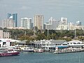
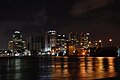
Miami
Fort Lauderdale
West Palm Beach


population
Demographics
| census | population |
|---|---|
| 1900 | 4,955 |
| 1910 | 17,510 |
| 1920 | 66,542 |
| 1930 | 214,830 |
| 1940 | 387,522 |
| 1950 | 693.705 |
| 1960 | 1,497,099 |
| 1970 | 2,236,645 |
| 1980 | 3,220,844 |
| 1990 | 4,056,100 |
| 2000 | 5,007,564 |
| 2010 | 5,564,635 |
Southern Florida is a diverse population, with a high percentage of non-native Americans. A large part of this is made up of people from Latin America due to the neighboring Caribbean . In addition, many Americans from northern states have their primary or secondary residence here; especially many retirees settle in the area due to the warm climate.
In addition to the predominant Christian denominations, there is a high proportion of Jewish people in the region (10.2%) . In addition, around 70,000 Americans who have converted to Islamic faith live here .
In 2010, around 52% of the region's 5,564,635 inhabitants were female (around 2.8 million) and 48% were male (around 2.6 million). The mean age was 38.6 years. A share of 24% of the population was younger than 18 years and 15% at least 65 years old. A total of 2,097,626 households and 1,378,108 families were registered in the metropolitan area.
- White : 70.3% [3914239]
- African Americans (mostly from the Caribbean ): 21% [1,075,174]
- Natives : 0.3% [16,108]
- Asian Americans : 2.3% [125,564]
- Pacific Islander : 0.0% [2,356]
- Other ethnic groups: 3.5% [197,183]
- Multiracial Americans : 2.5% [140,000]
Hispanics and Latinos make up 41.6% [2,312,929] of the population.
Origin and languages

Around 30% of the current metropolitan area population are native Florida residents, which together with an additional 33% from other areas of the United States makes a total of 63% Native Americans. Hence about 37% of the population were born abroad. Of the people who have lived there since at least five years of age in 2005, 52% speak English , 48% speak other languages. Of the foreign language speakers, 78% speak Spanish and the remaining 22% mainly speak Haitian , but also languages such as French , German , Hebrew , Italian , Brazilian , Russian or Yiddish . 47% of the population said they could not speak "very well" English.
In 2005, 83% of the population had lived in the place where they lived for at least a year. 12% moved within the county and another 2% moved from another Florida county. Another 2% immigrated from another state and 1% from abroad.
The total of 2,338,450 households in 2005 consisted of an average of 2.6 people per household. Of these, 65% of the households were families, each consisting of 45% families with married couples and 20% other families. Most of the 35% remaining households were run by individuals.
Education
In 2005, of the population aged 25 or over, 30% had a bachelor's degree and 83% had a high school degree. About 7% of the 16 to 19 year old population were early school leavers. That year there were a total of 1.4 million school registrations. Of which sprang 170,000 for kindergarten or preschool, 879,000 in primary school ( Primary School or Elementary School ) and the high school and 354,000 to the college or university.
education


In Florida, each county is also a school district headed by an elected body. The committee, in turn, is headed by a full-time supervisor who manages the day-to-day business of the school district.
Some colleges and universities in the region are listed below:
- Barry University (private / Catholic)
- Broward College (state)
- Carlos Albizu University (private)
- Florida Atlantic University (state)
- Florida International University (state)
- Florida Memorial University (private)
- Johnson & Wales University (private)
- Le Cordon Bleu College of Culinary Arts Miami (private)
- Lynn University (private)
- Miami Dade College (state)
- Northwood University (private)
- Nova Southeastern University (private)
- Palm Beach Atlantic University (private / Christian)
- Palm Beach State College (state)
- St. Thomas University (private / Catholic)
- University of Miami (private)
economy
The metropolitan region generated an economic output of 328.5 billion US dollars in 2016, making it 12th among the greater metropolitan areas of the USA.
traffic

Streets

The region is crossed by five interstate highways operated by the Florida Department of Transportation (FDOT) . The main interstate is I-95 , which crosses all three counties from north to south. Starting in Maine , it leads along the US east coast and ends in Miami, where it merges into US Route 1 . The I-75 is the continuation of the SR 924 at Miami Lakes and leads in several arcs over Weston first through the Everglades west to Naples . From here it continues north via Tampa and Atlanta to Sault Ste. Marie on the Canadian border. In Broward County, I-595 connects I-75 at Weston to the west with I-95 and Fort Lauderdale Airport to the east. The I-195 and I-395 are two city highways that connect Miami Airport in the west with Miami Beach in the east, each crossing I-95.
In the greater Miami area, the private Florida's Turnpike Enterprise (FTE) operates together with the Miami-Dade Expressway Authority (MDX) some expressways, some of which are subject to tolls. These are Florida State Roads 112 , 826 , 836 , 874 , 878, and 924, as well as Florida's Turnpike , which begins at Golden Glades and runs north through eleven counties to Orlando , essentially parallel to I-95, with both freeways on share a common route for about 30 km.
The SR 869 in Broward County begins on I-75 at Weston and runs first north via Coral Springs and then further east to Deerfield Beach .
In addition, several other significant, but not intersection-free US highways and state roads run through the region, including US Highway 1 , which runs from Key West mostly parallel to I-95 to Fort Kent on the Canadian border.
Public transport

In long-distance rail transport, Amtrak connects Miami at the new airport station with several cities in the region and also with a direct connection with a large number of cities along the east coast as far as New York City. In regional traffic, the Tri-Rail serves 18 stations within the metropolitan area along a route from the Airport Station to Mangonia Park in Palm Beach County. Of these, from the Amtrak next to the Airport Station train stations Hollywood , Fort Lauderdale , Deerfield Beach , Delray Beach and West Palm Beach served.
In 2011 the construction of a high-speed line from Tampa via Orlando to Miami should have started. The route should be driven along the existing trunk road network at a planned speed of 270 to 300 km / h according to the principle of traffic route bundling . The plans were put on hold by Governor Rick Scott in March 2011.
Miami owns the suburban railway Metrorail and the inner-city elevated railway Metromover . The use of the latter is free of charge. Both trains are operated by Miami-Dade Transit together with the Metrobus bus system . Broward and Palm Beach Counties each operate their own bus companies, Broward County Transit and Palm Tran .
Airports


The region is served by three international airports. Together they handle the fourth largest traffic volume in the United States after New York City , Los Angeles and Chicago .
| Airport | IATA airport code | ICAO code | county |
|---|---|---|---|
| Miami International Airport | MIA | KMIA | Miami dade |
| Fort Lauderdale-Hollywood International Airport | FLL | KFLL | Broward |
| Palm Beach International Airport | PBI | KPBI | Palm Beach |
The following smaller airports are mainly used for domestic and private flights.
| Airport | IATA code | ICAO code | county |
|---|---|---|---|
| Dade-Collier Training and Transition Airport | TNT | KTNT | Miami dade |
| Homestead General Aviation Airport | Miami dade | ||
| Homestead Joint Air Reserve Base | HST | KHST | Miami dade |
| Kendall-Tamiami Executive Airport | TMB | KTMB | Miami dade |
| Grandpa-locka Executive Airport | OPF | HEAD | Miami dade |
| Fort Lauderdale Executive Airport | FXE | KFXE | Broward |
| North Perry Airport | HWO | KHWO | Broward |
| Pompano Beach Airpark | PPM | KPMP | Broward |
| Boca Raton Airport | BCT | KBCT | Palm Beach |
| North Palm Beach County General Aviation Airport | Palm Beach | ||
| Palm Beach County Park Airport | LNA | KLNA | Palm Beach |
Seaports

The region has four seaports , of which the port of Miami is the largest in Florida. It is also the ninth largest container port in the United States and the largest port for cruise ships in the world. The other three ports are Port Everglades , the Port of Palm Beach and the Port Miami River . On August 21, 2012, a decision was taken to deepen the port of Miami in response to the expansion of the Panama Canal planned for 2015 . It will then be the only seaport south of Norfolk , Virginia with a water depth of over 50 feet . The expansion will create more than 30,000 direct and indirect jobs and will double the port's turnover figures into the next decade.
Sports

- The Miami Dolphins play in the National Football League and play their home games at Sun Life Stadium in Miami Gardens .
- The Miami Heat play in the National Basketball Association and play their home games at the American Airlines Arena in Downtown Miami .
- The Miami Marlins play Major League Baseball and play their home games at Marlins Park in Little Havana .
- The Florida Panthers play in the National Hockey League and play their home games at the BankAtlantic Center in Sunrise .
- The Fort Lauderdale Strikers played in the North American Soccer League and played their home games at Lockhart Stadium in Fort Lauderdale .
- The Miami Marlins and St. Louis Cardinals conduct their jumping training in Jupiter at Roger Dean Stadium .
- The Baltimore Orioles conduct their spring training in Fort Lauderdale at Fort Lauderdale Stadium .
- The region is also home to the sports teams of Barry University , Florida Atlantic University , Florida International University ( FIU Stadium , US Century Bank Arena, and FIU Baseball Stadium ), Nova Southeastern University, and University of Miami ( Sun Life Stadium , BankUnited Center, and Mark Light Field ).
- The Homestead-Miami Speedway is the venue of events of the NASCAR and IndyCar series . The Palm Beach International Raceway is a smaller racetrack.
See also
Individual evidence
- ^ Dean Whitman: Notes on the geology and Water Resources of South Florida . In: Notes on Florida Geology . Florida International University . September 1997. Retrieved January 11, 2011.
- ↑ Darlene F. Williams: Proposed Metropolitan Area Definitions for FY2006 Income Limits and Estimates of Median Family Income . In: Federal Register . 2005, pp. 74988-74993. Retrieved January 12, 2011.
- ↑ John Mark ocher Bloom: Miami Metropolitan Area (Fla.) . In: The Online Books Page . University of Pennsylvania . January 1, 2011. Retrieved January 12, 2011.
- ↑ CONSUMER EXPENDITURES FOR THE MIAMI AREA: 2008-09 (PDF; 301 kB) In: News Release . United States Department of Labor ( Bureau of Labor Statistics ). October 28, 2010. Retrieved January 12, 2011.
- ^ Journey-To-Work Trends in the United States and its Major Metropolitan Areas 1960–1990 . In: Research and Innovative Technology Administration National Transportation Library . Federal Highway Administration . June 2003. Retrieved January 12, 2011.
- ↑ OMB Bulletin No. 10-02: Update of Statistical Area Definitions and Guidance on Their Uses (PDF; 522 kB) Office of Management and Budget . December 1, 2009. Retrieved May 30, 2012.
- ^ "Hurricane & tropical storm impacts over the South Florida Metropolitan area: Mortality & government"
- ↑ http://www.census.gov/popest/metro/files/2009/CBSA-EST2009-alldata.csv ( CSV ) In: 2009 Population Estimates . United States Census Bureau . July 1, 2009. Retrieved April 28, 2010.
- ↑ 2010 Census: Florida . In: USA Today . Retrieved November 8, 2011.
- ↑ Census Bureau Geographic Concepts (PDF; 6.0 MB). Accessed July 2, 2009
- ↑ Metropolitan and micropolitan statistical areas defined by the Office of Management and Budget, December 2009.Retrieved July 22, 2011
- ↑ S. Fla's 70,000 Muslims start holy month of Ramadan . In: The Miami Herald , August 22, 2009, p. B3.
- ↑ American FactFinder, United States Census Bureau: and Housing Narrative Profile: 2005 . Factfinder.census.gov. Retrieved November 8, 2011.
- ^ US Department of Commerce, BEA, Bureau of Economic Analysis: Bureau of Economic Analysis. Retrieved July 4, 2018 (American English).
- ^ Alan Berube, Jesus Leal Trujillo, Tao Ran, and Joseph Parilla: Global Metro Monitor . In: Brookings . January 22, 2015 ( brookings.edu [accessed July 4, 2018]).
- ↑ Jackovics, Ted. January 28, 2010, "Obama calls high speed rail funding a 'down payment'". ( Memento of the original from January 5, 2013 in the web archive archive.today ) Info: The archive link was automatically inserted and not yet checked. Please check the original and archive link according to the instructions and then remove this notice. The Tampa Tribune (TBO.com). . Retrieved February 18, 2010.
- ↑ Janet Zink: No high-speed rail for Florida; court rules for Scott, feds move to give money to someone else . In: St. Petersburg Times , March 5, 2011. Archived from the original on March 7, 2011 Info: The archive link was inserted automatically and has not yet been checked. Please check the original and archive link according to the instructions and then remove this notice. . Retrieved April 13, 2011.
- ↑ Archived copy ( Memento of the original from April 8, 2008 in the Internet Archive ) Info: The archive link was inserted automatically and has not yet been checked. Please check the original and archive link according to the instructions and then remove this notice.