
Florida State Road A1A

|
|
|---|---|
| Basic data | |
| Overall length: | 328.92 mi / 529.35 km |
| Opening: | 1945 |
| State: |
Florida |
| Starting point: | First Street / Flagler Avenue in Key West |
| End point: |
|
| Counties: |
Monroe , Miami-Dade , Broward , Palm Beach , Martin , St. Lucie , Indian River , Brevard , Volusia , Flagler , St. Johns , Duval , Nassau |
The Florida State Road A1A (short FL A1A ) is a state highway in the US state of Florida , the north-south-running in. It usually runs close to the coast along the east coast of the state.
Route
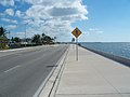
The State Road begins in Key West in Monroe County and runs on a short section of the Overseas Highway together with US Highway 1 to Marathon . The route as A1A to Miami is then interrupted. Only the MacArthur Causeway from Miami to Miami Beach has this name again. Then, with a few exceptions, the road leads along barrier islands between the Atlantic Intracoastal Waterway and the Atlantic Ocean along the Florida coast. Exceptions to this are a section at Fort Lauderdale , another section from West Palm Beach to Riviera Beach , from Jupiter to Stuart , at Fort Pierce and from Cocoa to Daytona Beach . In these cases the route is often identical to US Highway 1 ( FL 5 ). At Jacksonville , the St. Johns River is crossed by ferry. At Fernandina Beach , just before the Georgia border , the road leaves the coastal area and turns west. It continues over Yulee , crosses Interstate 95 and ends in Callahan , Nassau County .
Web links
- South East Roads (Engl.)
A1A in Key West

A1A in Boca Raton

A1A in Daytona Beach


