Bredenbek (Alster)
| Bredenbek | ||
|
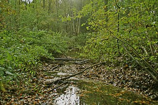
The Bredenbek at the confluence with the Alster |
||
| Data | ||
| location | Schleswig-Holstein , Hamburg ; Germany | |
| River system | Elbe | |
| Drain over | Alster → Elbe → North Sea | |
| source | North of Wulfsdorf 53 ° 39 ′ 43 ″ N , 10 ° 13 ′ 0 ″ E |
|
| Source height | 37.5 m above sea level NHN | |
| muzzle | At Ohlstedt in the Alster coordinates: 53 ° 41 ′ 9 ″ N , 10 ° 7 ′ 0 ″ E 53 ° 41 ′ 9 ″ N , 10 ° 7 ′ 0 ″ E |
|
| Mouth height | 13 m above sea level NHN | |
| Height difference | 24.5 m | |
| Bottom slope | 3.1 ‰ | |
| length | 8 kilometers | |
The (also: the) Bredenbek is an 8 kilometer long river in the south of Schleswig-Holstein and in the north of Hamburg .
The Bredenbek rises north of the Wulfsdorf district, which belongs to Ahrensburg, and west of Hamburger Strasse (formerly B 75 ). It has been dammed up to the Bredenbeker pond near Ammersbek since the 15th century . To the west of Hoisbüttel , the Bredenbek enters the Hamburg area and flows into the Alster in the Rodenbeker Quellental near Ohlstedt .
Tributaries
The only tributary of concern today is the Lottbek , which flows into the Bredenbek shortly before it flows into the Alster. The Hopfenbach , which drains the Ahrensburg tunnel valley , also flowed into the Bredenbek until the 16th century . It was diverted into the floodplain through an artificial puncture .
Bredenbeker pond
The Bredenbeker pond is still a popular destination north of Hamburg between Ahrensburg and Ammersbek-Bünningstedt .
It was the end of the 15th century by the Cistercian - Kloster Reinbek created for fish farming and in 1585 by Peter Rantzau , the owner of the goods Ahrensburg increased. In 1924, the Hamburg timber merchant Wilhelm Gratenau bought the pond and the surrounding lands with the Lindenhof estate. On the north bank of the pond, he created a large lido , which in the warm summer months also met with great interest from many Hamburg bathers traveling on the Walddörferbahn . Later, a campsite and two golf courses were also built on the north bank of the pond .
The lido and the campsite are still there today and have been operated by the CBT e. V. (Camping Association Bredenbeker Teich) operated. The lido is open from mid-May to mid-August - except on days with bad weather - between 10:00 a.m. and 7:00 p.m.
The bathing lake is located in the north-western area of the site. The Bredenbeker Teich site has two other lakes that extend east to the city of Ahrensburg. The lakes were created for 60 years by the Anglerverein Alster e. V. until the lease was terminated prematurely in 2016. The following fish species are found: various white fish ( bream , roach and rudd ), crucian carp , tench , eel , perch , pike , pikeperch and rainbow trout . The water quality of the Bredenbeker pond has been proven to be very good.

