Burgstall on the Hasenleite
| Burgstall on the Hasenleite | ||
|---|---|---|
|
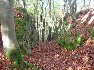
Image 1: View of the castle rock, in the foreground the outer wall of the hillside moat. View from the south (2007) |
||
| Creation time : | Medieval | |
| Castle type : | Höhenburg, spur location | |
| Conservation status: | Burgstall, a moat with outer wall visible | |
| Standing position : | Unknown | |
| Construction: | Presumably wooden system (tower) | |
| Place: | Hartenstein - Grünreuth - "Hasenleite" | |
| Geographical location | 49 ° 35 '25.3 " N , 11 ° 32' 23.6" E | |
| Height: | 555.2 m above sea level NN | |
|
|
||
The castle stables on the Hasenleite are the remnants of an unknown, abandoned medieval spur castle that once stood on a rock spur of the so-called Hasenleite. The Burgstall is located west-northwest of the village of Grünreuth in the municipality of Hartenstein in the district of Nürnberger Land in Bavaria , Germany . To this day, nothing more is known about this small castle complex, neither who built it, who sat on it or why it was destroyed. Today, only a moat with an outer wall remains of the object, which is protected as a ground monument.
Geographical location
The Burgstall is located about 340 meters west-northwest of the village of Grünreuth, or 1360 meters southeast of the Catholic parish church of Sankt Trinitas in Hartenstein.
The place of the abandoned castle is in the Middle Franconian Jura , on an east-facing rock spur and at the same time the highest point of 555.2 m above sea level. NN high Hasenleite. This rock spur drops vertically to the north, which is why this side is naturally best protected. The east side also drops several meters steeply over rocks into a natural railing channel. The southern side of the castle rock forms a steeply rising slope, to the west the castle rock changes almost at the same height into a flat hilltop, here the complex had to be secured by a ditch.
history
No historical data are known about the castle, which Brigitte Kaulich discovered in the 1880s. Since it was only about 500 meters away from the headquarters of Grünreuth, it could be related to this.
description
The wooded castle site lies on a rock head that rises at the end of a terrain spur (Fig. 1). Since the vertical rockfall offered natural protection on the north and east sides, no protective measures had to be taken there. To the west, on the other hand, a neck ditch hewn out of the rock was presented to the castle stable , which is about eleven meters long and two meters deep (Fig. 3). To the south, where the castle rock drops steeply a few meters, a ditch was dug . The excavated material from the two trenches forms a wall on the outside of the sloping trench. This wall is still around one meter high and twelve meters long (Fig. 2).
There are no remains of walls or other traces of construction on the rock head itself, such as B. rock processing more visible, so Kaulich suspected that it could have been wooden structures.
literature
- Brigitte Kaulich: A castle stable on the Hasenleite near Grünreuth, Gde. Hartenstein, district of Nürnberger Land . In: Contributions to archeology in Middle Franconia, Volume 7 . Publishing house Dr. Faustus, Büchenbach 2003, pp. 189–194.
- Robert Giersch, Andreas Schlunk, Berthold Frhr. von Haller: Castles and mansions in the Nuremberg countryside . Altnürnberger Landschaft, Lauf an der Pegnitz 2006, ISBN 978-3-00-020677-1 , p. 152.


