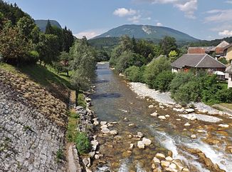
Cheran
| Cheran | ||
|
The Chéran in Lescheraines |
||
| Data | ||
| Water code | FR : V1250500 | |
| location | France , Auvergne-Rhône-Alpes region | |
| River system | Rhône | |
| Drain over | Fier → Rhône → Mediterranean | |
| source | on the municipal boundary of Verrens-Arvey and Jarsy 45 ° 40 ′ 49 ″ N , 6 ° 15 ′ 27 ″ E |
|
| Source height | approx. 1990 m | |
| muzzle | below Rumilly in the Fier coordinates: 45 ° 53 ′ 11 ″ N , 5 ° 56 ′ 0 ″ E 45 ° 53 ′ 11 ″ N , 5 ° 56 ′ 0 ″ E |
|
| Mouth height | approx. 320 m | |
| Height difference | approx. 1670 m | |
| Bottom slope | approx. 31 ‰ | |
| length | 54 km | |
| Small towns | Rumilly | |
|
The Pont de l'Abîme across the river, below Allèves |
||
The Chéran (German: Seran ) is a mountain river in France that runs in the Auvergne-Rhône-Alpes region . It rises in the Massif des Bauges , south of the Pointe de Chaurionde, on the municipal boundary of Verrens-Arvey and Jarsy , initially drains in a south-westerly direction, later in a north-westerly direction through the Massif des Bauges Regional Nature Park of the same name and flows 54 kilometers below Rumilly as the left Tributary to the Fier . On its way, the Chéran touches the Savoie and Haute-Savoie departments .
Places on the river
Web links
Commons : Chéran - collection of images, videos and audio files

