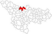
Cornești (Timiș)
|
Corneşti, Jadani Schadan Mezőzsadány |
||||
|
||||
| Basic data | ||||
|---|---|---|---|---|
| State : |
|
|||
| Historical region : | Banat | |||
| Circle : | Timiș | |||
| Municipality : | Orțișoara | |||
| Coordinates : | 45 ° 54 ' N , 21 ° 13' E | |||
| Time zone : | EET ( UTC +2) | |||
| Residents : | 555 (2002) | |||
| Postal code : | 307307 | |||
| Telephone code : | (+40) 02 56 | |||
| License plate : | TM | |||
| Structure and administration | ||||
| Community type : | Village | |||
Cornești (outdated: Jadani , German: Schadan , Hungarian: Mezőzsadány ) is a village in Timiș County , Banat , Romania . Cornești belongs to the Orțișoara municipality .
Geographical location
Corneşti is located in the north of Timiş County, near the border with Arad County , 21 kilometers north of the district capital Timişoara .
Neighboring places
| Bărăteaz | Orțișoara | Seceani |
| Carani |

|
Murani |
| Sânandrei | Covaci | Giarmata |
history
The village was first mentioned in a document in 1233. 1318 Zadane appears in the documents of the time. In the papal tithe lists (1334-1337) Sacerdos de Sadan is noted. On the Josephine land survey of 1717 the place Schadain is registered with 10 houses. Later Germans and Hungarians were also settled in the village, but the Romanians always remained in the majority. After the Austro-Hungarian Compromise (1867), the Banat was annexed to the Kingdom of Hungary within the dual monarchy of Austria-Hungary . The official place name was Mezőzsadány . The Treaty of Trianon on June 4, 1920 resulted in the triple division of the Banat, whereby Jadani fell to the Kingdom of Romania . In 1964 the place name was changed to Corneşti .
Corneşti fortress
Corneşti Fortress is the largest fortified prehistoric settlement from the Bronze Age in Europe. The fortress has four wall rings with moats. The inner ring has a diameter of 1 kilometer, the outer one of 6. The total area is approximately 1700 hectares. The fortress appears on the Mercy map (1723–1725) and thereafter on all military maps up to the First World War. The first excavations were carried out in 1939. In 2007 these were resumed thanks to Alexandru Szentmiklosi, the then director of the archaeological department of the Banat Museum .
In cooperation with the employees of the Johann Wolfgang Goethe University Frankfurt am Main and the University of Exeter , a special excavation was carried out inside the settlement, whereby an early Iron Age cultural layer was found. However, an exact dating of the entire complex has not yet been successful. For this reason, the institutions involved will carry out more extensive excavations and investigations on site in the coming years.
Demographics
| census | Ethnicity | |||||||
|---|---|---|---|---|---|---|---|---|
| year | Residents | Romanians | Hungary | German | Other | |||
| 1880 | 1170 | 1018 | 45 | 79 | 28 | |||
| 1910 | 1026 | 890 | 111 | 23 | 2 | |||
| 1930 | 969 | 908 | 37 | 14th | 10 | |||
| 1977 | 717 | 662 | 54 | 1 | - | |||
| 2002 | 555 | 516 | 32 | - | 7th | |||
Web links
- digi24.ro , Corneşti Fortress
- evz.ro , Archaeological excavations near Corneşti
- extraterestriiprintrenoi.wordpress.com , The oldest Bronze Age fortress in Europe
Individual evidence
- ↑ a b extraterestriiprintrenoi.wordpress.com , The oldest fortress from the Bronze Age in Europe
- ↑ a b degruyter.com , To the wall rings of Corneşti
- ↑ kia.hu , E. Varga: Statistics of the population by ethnic group in Timiș County according to censuses from 1880-2002


