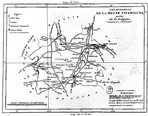
Meuse-Inférieure department
The Département de la Meuse-Inférieure ( German department of the lower Maas and Lower Maas ; Dutch Departement van de Beneden-Maas also Nedermaas ) was a 1795 to 1814 the French state belonging department . It included parts of what is now Belgium and the Netherlands and, to a lesser extent, Germany .
history
Until the end of the 18th century, the department's territory comprised various territories , mainly:
- Parts of the Duchy of Limburg and the Duchy of Geldern , both belonging to the Austrian Netherlands ,
- Parts of the Principality of Liège ,
- to the Generalitätslanden the United Republic of the Seven Provinces belonging areas of Maastricht and Venlo .
After the Brabant Revolution , the Republic of the United Belgian States emerged in 1790 from what had previously been part of the Austrian Netherlands . The Principality of Liège was occupied in 1791. The entire region was formally attached to France on October 1, 1795. Maastricht and Venlo, the now from the United Seven Dutch provinces formed Batavian Republic ceded to France.
As early as 1795, the administration and the judiciary were adapted to the new French system, a total of nine departments were created in the area of the formerly Austrian Netherlands and other territories in the region , which were administratively divided into arrondissements , cantons and communes. The cantons were also district courts of justice .
After the victory over Napoléon in the Battle of Leipzig (1813) and the Congress of Vienna (1815), the department became part of the United Kingdom of the Netherlands as the province of Limburg , and a small part ( Niederkrüchten ) became part of Prussia .
structure
The main town ( chef-lieu ) of the department or seat of the prefecture was the city of Maastricht . The prefecture was located in the “Het Oud Gouvernement” building at the Bouillonstraat - Lenculenstraat intersection. The department was divided into three arrondissements and 23 cantons , as well as 310 municipalities:
| Arrondissement | Main towns in the cantons, seat of the courts of justice |
|---|---|
| Maastricht | Bilzen , Gulpen , Kerkrade (canton Rolduc), Heerlen , Maastricht (2 cantons), Mechelen , Meerssen , Oirsbeek , Tongeren |
| Hasselt | Beringen , Hasselt , Herk , Loon , Peer , Sint-Truiden |
| Roermond | Achel , Bree , Maaseik , Niederkrüchten , Roermond , Venlo , Weert |
The department had an area of 3,786 square kilometers and in 1812 a total of 267,249 inhabitants.
See also
Individual evidence
- ^ A b Heinrich Karl Wilhelm Berghaus : Germany for a Hundred Years , Second Division, Third Volume, Leipzig: Voigt & Günther, 1862, p. 79 ( Google Books )
- ^ Carl von Rotteck : General Political Annals , Volume 7, Cotta'sche Buchhandlung, 1831, p. 105 ( Google Books )
- ↑ a b c Almanach Impérial 1812 , Paris, p. 436 ( Bibliothèque nationale de France )
- ^ Albrecht Friedrich Ludolph Lasius : The French Kayser State under the government of the Kayser Napoleon the Great in 1812 . A Geographical-Historical Manual, First Department, Osnabrück: Johann Gottfried Kißling, 1813, p. 322 ( Google Books )

