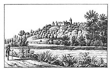
Kornberg near Riegersburg
|
Kornberg near Riegersburg (former municipality) Kornberg cadastral community |
||
|---|---|---|
|
|
||
| Basic data | ||
| Pole. District , state | Südoststeiermark (SO), Styria | |
| Judicial district | Feldbach | |
| Coordinates | 46 ° 59 '15 " N , 15 ° 55' 18" E | |
| height | 360 m above sea level A. | |
| Residents of the stat. An H. | 1132 (October 31, 2013) | |
| Building status | 391 (2001 ) | |
| Area d. KG | 15.97 km² | |
| Post Code | 8333 Riegersburg | |
| Primaries | + 43/3153 or +43/3152 (Dörfl) | |
| Statistical identification | ||
| Community code | 62386 | |
| Cadastral parish number | 62128 | |
| Counting district / district | Kornberg near Riegersburg (62386 004) | |
 Location of the former municipality in the district of Southeast Styria |
||
| Independent municipality until the end of 2014 Source: STAT : Local directory ; BEV : GEONAM ; GIS-Stmk |
||
Kornberg bei Riegersburg is a former municipality with 1132 inhabitants (as of October 31, 2013) in the south-east of Styria in the district of Southeast Styria . Since 2015 it has been merged with the market community of Riegersburg and the communities of Breitenfeld an der Rittschein and Lödersdorf as part of the structural reform of the municipality in Styria , the new municipality continues to carry the name "Riegersburg".
geography
Geographical location
Kornberg near Riegersburg is about 37 km east of Graz and about 2 km northeast of the district capital Feldbach in the Eastern Styrian hill country .
Neighboring communities by the end of 2014
- in the north: Riegersburg
- in the east: Lödersdorf
- in the south: Raabau and Feldbach
- in the west: Auersbach and Gniebing-Weißenbach
structure
The municipality consisted of the only cadastral municipality Kornberg and comprised the following five localities (number of inhabitants in brackets as of January 1, 2020):
- Bergl (299)
- Dörfl (191)
- Edelsgraben (119)
- Oberkornbach (121)
- Schützing (415)
Population development


politics
Municipal council
The municipal council consisted of 15 members and, since the municipal council election in 2010, has consisted of mandates from the following parties:
coat of arms
The municipal coat of arms was awarded with effect from January 1, 1994.
Blazon (coat of arms description):
- "In gold, a tinned blue tip that grows to the upper edge of the shield, covered with a golden straw wreath , decorated with three golden ears, one upright, the other two growing downwards laterally."
Culture and sights
- See also: List of listed objects in Riegersburg
- Kornberg is also known for the Kornberg Castle , where knight dinners are held in the vault of the knight's hall . Various events take place at the castle. A riding club is attached.
- The zotter chocolate factory is located in Bergl .
Web links
Individual evidence
- ↑ State of Styria: Final population status on October 31, 2013 ( Memento of the original from April 15, 2015 in the Internet Archive ) Info: The archive link was inserted automatically and has not yet been checked. Please check the original and archive link according to the instructions and then remove this notice. (Excel file, 85 kB; accessed on May 2, 2015)
- ↑ Announcement of the Styrian state government of October 31, 2013 on the unification of the market town of Riegersburg and the communities of Breitenfeld an der Rittschein, Kornberg near Riegersburg and Lödersdorf, all of the political district of Southeast Styria. Styrian Provincial Law Gazette of November 15, 2013. No. 132, 32nd issue. ZDB ID 705127-x . P. 635.
- ↑ Statistics Austria: Population on January 1st, 2020 by locality (area status on January 1st, 2020) , ( CSV )
- ↑ Communications from the Styrian State Archives 44/45, 1994/95, p. 56


