Danger Point (UK)
| Danger Point | ||
 Danger Point, view from the west. |
||
| Geographical location | ||
|
|
||
| Coordinates | 50 ° 37 '54 " N , 3 ° 18' 6" W | |
| Waters 1 | English Channel | |
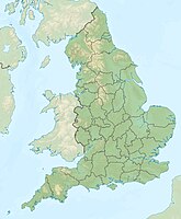
Danger Point is a promontory at the English Channel near the seaside resort of Budleigh Salterton in the county of Devon in southern England .
location
Danger Point is about eighteen kilometers southeast of the city of Exeter , along the coastline about halfway between Exmouth and Sidmouth . Just a few hundred yards west of Danger Point is the mouth of the River Otter , from where Budleigh Salterton Beach stretches to Littleham Cove .
Jurassic Coast
The cliffs of the English Channel of East Devon and Dorset are one of the natural wonders of the world. From Orcombe Point at Exmouth to Old Harry Rocks at Studland Bay , a 155 km long coastline, the first natural landscape in England by ranging UNESCO for World Heritage declared. The rock face at Danger Point is part of what is known as the Jurassic Coast .
The Jurassic Coast rock strata tilts slightly to the east. The geologically oldest rocks are therefore in the westernmost section of this coastal geotope . The mean age of the rocks gradually decreases towards the east. The natural outcrops along the coast form a largely continuous sequence, ranging from deposits of the Triassic , through those of the Jura to those of the Cretaceous period, and represents a geological period totaling around 185 million years. The storage room that received the sediment series from the Jurassic Coast at that time is the so-called Wessex Basin .
Geological details
Danger Point is still relatively far to the west of the Jurassic Coast and therefore the rocks there are among the older deposits of this cliff coast . These are red sandstones from the Triassic, lithostratigraphically called Otter Sandstone Formation (roughly translatable as Otter Sandstone Formation ). The otter sandstone was deposited by rivers in a lowland plain with a warm, dry climate. Fossils found in the otter sandstone indicate that plants grew and large reptiles lived on the banks of these rivers.
The cliff of Danger Point is part of the type profile of the otter sandstone.
See also
Web links
- Ian West: Budleigh Salterton, Littleham Cove and Straight Point, Devon: Geology of the Wessex Coast. 2012 richly illustrated online excursion guide
Individual evidence
- ^ Dorset and East Devon Coast . UNESCO World Heritage Center. 2001. Retrieved October 19, 2010.
- ↑ Data sheet of the Otter Sandstone Formation in the online encyclopedia of named rock units of the British Geological Survey
