Chachapoyas District
| Chachapoyas District | |||
|---|---|---|---|
 Location of the district in Chachapoyas Province |
|||
| Symbols | |||
|
|||
| Basic data | |||
| Country | Peru | ||
| region | Amazon | ||
| province | Chachapoyas | ||
| Seat | Chachapoyas | ||
| surface | 153 km² | ||
| Residents | 32,589 (2017) | ||
| density | 213 inhabitants per km² | ||
| ISO 3166-2 | PE-AMA | ||
| politics | |||
| Alcalde District | Víctor Raúl Culqui Puerta (2019-2022) |
||
| Political party | Unión por el Perú | ||
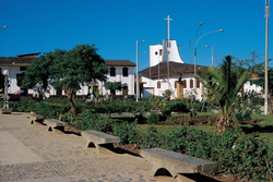
| Plaza de Armas in Chachapoyas | |||
Coordinates: 6 ° 14 ′ S , 77 ° 52 ′ W
The Chachapoyas District is one of 21 districts in the Chachapoyas Province in the Amazonas region of northern Peru . The district has an area of 153 km². In the 2017 census, 32,589 people lived in the district. In 1993 the population was 17,447, in 2007 23,939. The administrative seat is the city of Chachapoyas, both provincial and regional capital.
Towns, villages and homesteads in the Chachapoyas district
- Achamaqui
- Bocanegra
- Caclic
- Chachapoyas
- El Alfalfar
- El Atajo
- El Cruce
- El Franco
- El Molino
- El Tapial
- Hidalgo
- Jupia
- Leticia
- Lucmauro
- Maripata
- Membrillo
- Mitopampa
- Opelel
- Osmal
- Penca Pampas
- Pollapampa
- Pucacruz
- Puente Utcubamba
- Rondon
- Sacra Huayco
- San Antonio
- San Isidro
- Santa Cruz
- Santa Isabel
- Silva Urco
- Taquia
- Taquipampa
- Villa Paris
- Vitaliano
See also
Web links
Commons : Chachapoyas District - Collection of images, videos and audio files
- Peru: Amazonas region (provinces and districts) at www.citypopulation.de


