Soloco District
| Soloco District | |
|---|---|
| Basic data | |
| Country | Peru |
| region | Amazon |
| province | Chachapoyas |
| Seat | Soloco |
| surface | 74.7 km² |
| Residents | 1224 (2017) |
| density | 16 inhabitants per km² |
| founding | February 5, 1861 |
| ISO 3166-2 | PE-AMA |
| politics | |
| Alcalde District | Eder Jhon Zuta Tochon (2019-2022) |
| The village of Soloco | |
Coordinates: 6 ° 18 ′ 41 ″ S , 77 ° 45 ′ 15 ″ W
The Soloco District is one of 21 districts of Chachapoyas Province in the Amazon region . It has an area of 74.7 km². In the 2017 census, the population was 1224. In 1993 it was 1731, in 2007 it was 1413.
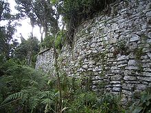
In the Soloco district there are huge ruins and fortresses of the Chachapoya culture .

Geographical location
The administrative seat of the district is the place Soloco. This is located at an altitude of 2400 m above sea level. The entire Soloco district is located in the high mountains and flattens out towards the Sonche River .
In the north, the Soloco district borders on the San Francisco de Daguas and Molinopampa districts , in the east on the Cheto district , in the south on the Cochmal and San Isidro de Maino districts, and in the west on the Chachapoyas and Levanto districts .
caves
In 2011, the discovery of a cave system of around 20 kilometers in length in the area around the district capital was announced.
Web links
- Peru: Amazonas region (provinces and districts) at www.citypopulation.de
Individual evidence
- ↑ Amazon: Soloco begins advertising its caves . Infoamazonas.de. Retrieved October 14, 2011.
