Pangoa District
| Pangoa District | |
|---|---|
 The district of Pangoa is located in the southwest of the province of Satipo (marked in red) |
|
| Basic data | |
| Country | Peru |
| region | Junín |
| province | Satipo |
| Seat | San Martin de Pangoa |
| surface | 3536 km² |
| Residents | 54,240 (2017) |
| density | 15 inhabitants per km² |
| founding | March 26, 1965 |
| ISO 3166-2 | PE-JUN |
| Website | www.munipangoa.gob.pe (Spanish) |
| politics | |
| Alcalde District | Celso Sixto León Llallico (2019-2022) |
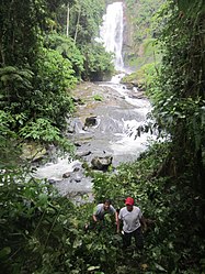
| Catarata Valle Sagrado | |
Coordinates: 11 ° 26 ′ S , 74 ° 29 ′ W
The district of Pangoa is one of the eight districts in the Junín region in central Peru , which together form the province of Satipo . It is one of the river valleys of the Apurímac , Éne and Mantaro known as " VRAEM " and is the scene of clashes between Peruvian armed forces , drug criminals and Sendero Luminoso . The district was founded on October 1, 1962.
Capital
The district capital is San Martín de Pangoa .
population
In the 2007 census, 29,595 inhabitants were counted. In the 2017 census, the population was 54,240.
geography
The highest place in the district is "Interandino", which is 1491 meters above sea level.
military
The Comando Especial VRAEM maintains small barracks in Micaela Bastidas and Boca Anapati .
Individual evidence
- ↑ http://www.infoamazonas.de/2012/08/16/junin-peru-offenbar-mehrere-tote-bei-terroristen-attacke-auf-militarbasis.html
- ↑ http://www.inei.gob.pe
- ^ Peru: Junín Region - Provinces and Districts . www.citypopulation.de. Retrieved December 6, 2019.
- ↑ VRAEM: Así fue la inspección en la base contraterrorista (PHOTOS). September 24, 2014, accessed November 9, 2018 (Spanish).
Web links
Commons : Pangoa District - Collection of images, videos and audio files
