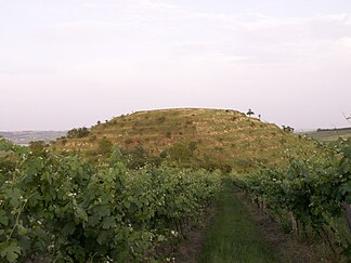
Dunajovické vrchy
| Dunajovické vrchy | ||
|---|---|---|
|
Velká Slunečná |
||
| Highest peak | Jánská hora ( 285 m nm ) | |
| location | Jihomoravský kraj , Czech Republic | |
| part of | Thaya-Schwarza Depression | |
|
|
||
| Coordinates | 48 ° 50 ′ N , 16 ° 34 ′ E | |
| surface | 67 km² | |
The Dunajovické vrchy , also Dunajovické hřbety , Dunajovické kopce or Hmota Dunajovická (German Tannowitzer Mountains , also Tannowitzer Kuppen or Tannowitzer ridges ) are a mountain range in South Moravia , Czech Republic . They are located northwest of Mikulov ( Nikolsburg ) in the southwest part of the Thaya-Schwarza Depression .
geography
The Dunajovické vrchy rise to the right of the Thaya on the southwest bank of the reservoirs of Nové Mlýny. In the north, the wide Dyjsko-svratecká niva ( Thaya-Schwarza lowland ) flooded with the two upper reservoirs of Nové Mlýny connects . To the east, the valley of the Dunajovický potok ( Retzbach ) separates the ridge from the significantly higher Pavlovské vrchy ( Pollau Mountains ). Towards the south, the Dunajovické vrchy continue over the Grenzbach Polní potok / Ottenthaler Bach on Lower Austrian territory to the Weinviertel hill country . The Laa Bay connects to the southwest . To the west, the Dunajovické vrchy also descend to the Dyjsko-svratecká niva; behind it rises the hill country Drnholecká pahorkatina ( Dürnholzer hill country ).
The Dunajovické vrchy have an area of 67 km² on Czech territory. Settlements are Brod nad Dyjí , Dolní Věstonice , Horní Věstonice , Dolní Dunajovice , Novosedly , Dobré Pole , Březí , Nový Přerov , Wildendürnbach , Neuruppersdorf and Alt-Prerau .
The back of the Dunajovické vrchy are made under bathe African pebble conglomerates. The lowlands are filled with calcareous clays and sands from the sub-basin. In the dry valleys there are fillings of diluviofluvial sediments. Black earth soils alternate with cambisole pararendzines . Almost all of the area is used for agriculture; the partly terraced hills as apricot gardens and vineyards . The forest areas are very small.
Subunits
- Březská sníženina ( Bratelsbrunn Valley )
- Brodská sníženina ( Guldenfurt Depression )
- Dunajovická sníženina ( Tannowitz Valley )
- Přední Dunajovický hřbet ( Front Tannowitz Ridge )
- Zadní Dunajovický hřbet ( Rear Tannowitz Ridge )
Significant surveys
- Jánská hora ( Johannesberg ), 285 m nm
- Velká Slunečná ( High Sunny Mountain), 283.1 m nm
- Růžová hora, 282 m nm
- Rochusberg, 278 m nm
- Malá Slunečná ( Little Sun Mountain ), 275 m nm
- Suchá hora ( Turnberg ), 272 m nm
- Liščí kopec ( Fox Mountain ), 271.7 m nm
- Syslík, 265 m nm
- Ořechová hora ( Bratelsbrunn Mountain ), 263 m nm
- Zimní vrch ( plates ), 260 m nm
- Lange Warth / Velký Kopec, 256 m nm
- Heidberg, 256 m above sea level A.
- Galgenberg, 255 m above sea level A.
natural reserve
The southern slope of the Liščí Kopec was declared a strictly protected botanical reserve in 1946 by the Mikulov District Administrative Commission . The remaining part of the consistently cultivated main ridge Zadní Dunajovický hřbet received the status of a partially protected area, in which new afforestation, planting of orchards and quarries as well as plowing pasture areas were prohibited without the consent of the monument authority. In 1990, the Břeclav District National Committee identified part of the back as a protected natural formation ( chráněný přírodní výtvor ). In 1992 these protected areas were declared the Dunajovické Kopce National Natural Monument. The Dunajovické Kopce NPP covers a total area of 107.16 ha on the western slope of the Zadní Dunajovický hřbet and consists of three parts: the ridge and western slope of the ridge from the Malá Slunečná over the Jánská hora to the Růžová hora, the Velká Slunečná with its sloping terraces as well as the ridge from Rochusberg to Liščí kopec. Populations of low xerophilic shrubs, short-stemmed grasslands, rare and endangered plant species such as dwarf almond , forest steppe mugwort , Tatar sea cabbage and wolf's foot hermaphrodite as well as the European praying mantis and their habitats are protected . In 2005, the Dunajovické Kopce NPP was entered in the national list of Special Conservation Areas (EVL) according to the Habitats Directive.
The Czech part of the gravel riedel Lange Warth / Velký Kopec in the south of the Přední Dunajovický hřbet on the Austrian border has been protected as a natural monument of Lange Wart since 2002 on an area of 1.72 hectares . The purpose of protection is plant communities of dry grasslands with occurrences of a number of specially protected plant species.
On the Austrian side, on the Heidberg near Neuruppersdorf - also a gravel riedel - a natural monument is designated. Occurrences of the endangered horse tail feather grass and deer root are protected .
literature
- Walter Sperling : Geographical names in the Bohemian countries - online dictionary in collaboration with the Collegium Carolinum ( archived version )
Web links
- ↑ Maintenance plan of the NPP Dunajovické Kopce for 2020-2029
- ↑ Lange Wart AOPK ČR
- ^ Protected area network Lower Austria , 3.5. Heidberg in Wildendürnbach

