Edelbach (Kahl)
| Edelbach | ||
|
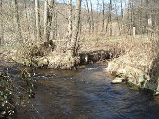
The Edelbach north of the sawmill near Edelbach |
||
| Data | ||
| location |
Spessart
|
|
| River system | Rhine | |
| Drain over | Kahl → Main → Rhine → North Sea | |
| source | southeast of Edelbach 50 ° 6 ′ 14 ″ N , 9 ° 18 ′ 50 ″ E |
|
| Source height | 334 m above sea level NHN | |
| muzzle | west of Edelbach in the Kahl coordinates: 50 ° 6 ′ 45 ″ N , 9 ° 16 ′ 57 ″ E 50 ° 6 ′ 45 ″ N , 9 ° 16 ′ 57 ″ E |
|
| Mouth height | 238 m above sea level NHN | |
| Height difference | 96 m | |
| Bottom slope | 37 ‰ | |
| length | 2.6 km | |
| Catchment area | approx. 4.2 km² | |
|
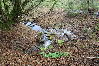
Main source of the Edelbach |
||
|
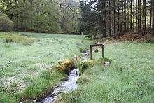
The Edelbach (right) flows into the Kahl |
||
The Edelbach is a left tributary of the Kahl in the district of Aschaffenburg in the Bavarian Spessart .
Surname
The Edelbach gave the place Edelbach , which it flows through, its name. Bach and place were called Ölbach until the 20th century.
geography
course
The Edelbach rises in the forest at the foot of the Eselshöhe mountain ridge below the Edelberg (477 m), between its two northern foothills, the Sommerberg (466 m) and the Ölberg (461 m). The sources of the Edelbach are located in the 130 m deep notched ring ground on the left side of the slope. The main source is located on the boundary to the community-free area Schöllkrippener Forst , below the Kleinkahler nature park hiking trail (K2). The above-ground catchment area of the Edelbach is around four square kilometers and extends up to the Spessart-Höhenstraße . The Ringgrund is dry from there to the source .
The Edelbach runs parallel to the AB 20 district road to the northwest. After about 250 m, on which it flows down almost 20 meters in altitude, it leaves the forest. There it is reinforced by a larger spring at a forest house and the stream from the Kafloos spring . In the Edelbach district, which belongs to Kleinkahl , it is crossed by the Degen-Weg , absorbs the water from other springs and used to drive two mills there. North of the sawmill , opposite the water treading facility , it crosses under the Kahltal-Spessart cycle path and flows into the Kahl .
Kahl river system
history
Glassworks
At the source of the Edelbach there was a glassworks that has now been abandoned in the late Middle Ages or in the early modern period , the former location of which is protected as a soil monument (D-6-5821-0036). Immediately to the east of it was the quarry from which the raw materials were extracted.
Mills
- Schnettersmühle (Obermühle)
- Göbelsmühle (Lower Mill)
See also the list of mills in the Kahlgrund .
See also
Web links
Individual evidence
- ↑ a b c d BayernAtlas of the Bavarian State Government ( notes )
- ↑ Our Kahlgrund 1980 . Homeland yearbook for the Alzenau district. Published by the working group for homeland research and homeland maintenance of the Alzenau district, district administrator. ISSN 0933-1328 .
- ↑ official list of monuments for Kleinkahl, page 3
- ↑ Headwaters of the Oelbach on a historical map


