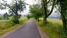
Epee way


The sword way , Dr. Degen-Weg or Dr. Heinrich-Degen-Weg is a 52 km long hiking trail through the Kahlgrund and the Spessart in the district of Aschaffenburg in Bavaria .
geography
It leads through the area of the former Alzenau district from the mouth of the Kahl am Main to the Dr. Kihnplatz near Wiesen and was named after the district administrator Heinrich Degen . It touches on the districts of the communities Alzenau , Mömbris , Krombach , Hösbach , Sailauf , Sommerkahl , Schöllkrippen and Kleinkahl . It also leads through the community-free areas of Sailaufer Forst , Schöllkrippener Forst and Wiesener Forst . The Spessart Association has marked the Degen-Weg with a black “D” on a white background and maintains it. There are four natural and around 30 architectural monuments directly on the Degen-Weg . Along with the Birkenhainer Road and the Franconian Marienweg forms of sword-path from the die height the circular route Kahlgrund-cocked.
Detailed history
The Degen-Weg begins on the Mainuferweg, directly at the mouth of the Kahl . It leads through the place Kahl over the Prischoss and the Unterwald to Wasserlos . Then it runs over the mountains Schanzenkopf , Elbernhöhe and Stempelhöhe. There he crosses the Franconian Marienweg. The Degen-Weg then runs in a north curve around the villages of Angelsberg and Molkenberg . In the further course it passes the places Rappach and Mömbris. There he crosses the Kahl and reaches Mensengesäß . The Degen-Weg leads over the Leißberghütte to Hof Hauenstein . From there it runs to Schimborn , crosses the Kahl again and leads to Rottenberg .
After Rottenberg the path runs past Eichenberg to Sommerkahl and past Schabernack , Kleinkahl, Edelbach to the Kahlquellen . At the Dr. Kihnplatz , northwest of Wiesen, the Degen-Weg ends at the intersection of Birkenhainer Straße and Eselsweg .
Route change 2011
Until 2011, the Degen-Weg led through the nature reserve amphibian free site Speckkahl , over the Eselshöhe am Engländer to Heinrichsthal , where it ended. At that time the trail was 40 km long. Only since the redesign has the hiking trail run through the upper Kahlgrund to the Dr. Kihnplatz .
Another route change was made in the area between the Stempelhöhe and Schimborn. Before that, the Degen-Weg ran over the Scharfenstein to Gunzenbach and through Heimbach to the Heimbacher Mühle . From there it led through the glass forest on the Glasberg to Schimborn.
Waypoints
|
Distinctive waypoints are:
|
Former prominent waypoints were:
|
topography
The topographically highest point of the Degen-Weg is at 471 m above sea level. NHN am Greifenberg , southeast of the Dr. Kihnplatz . The lowest is at 104 m above sea level. NHN in Kahl am Main on the Kahl. Before the route change, the highest point was at 515 m above sea level. NHN am Spindelberg southwest of Heinrichsthal.
Other high points of the path are the summit of the Reuschberg , which is 415 m above sea level. NHN lies and the north slope of the stamp height with 406 m above sea level. NHN .


